Maps of Iceland

Iceland, an island nation situated in the North Atlantic Ocean, directly borders the Greenland Sea and the Norwegian Sea. The country's total area encompasses approximately 103,125 km2 (39,817 mi2).
Southern Region: The Southern Region of Iceland is marked by a diverse landscape, including the expansive lowlands which are among the most fertile areas in the country. This region is known for its black sand beaches, a result of volcanic activity, and the Vatnajökull glacier, Europe's largest. The highest point in Iceland, Hvannadalshnúkur ("Hvannadals Peak"), stands at 2,119 meters (6,952 feet) and is part of the Öræfajökull volcano in this region.
Southwestern Region: This region includes the capital, Reykjavik, and is characterized by the Reykjanes Peninsula. Known for its volcanic and geothermal activity, the region features numerous hot springs and lava fields. The landscape is relatively flat compared to the rest of the country (albeit still rugged), with low hills and coastal plains.
Western Region: The Western Region is famous for the Snæfellsnes Peninsula, dominated by the Snæfellsjökull glacier and volcano. This region is characterized by dramatic cliffs, volcanic peaks, and rich coastal lowlands. The western fjords, though less deep and short compared to those in the northwest, add to the region's dramatic coastline.
Westfjords: The Westfjords are notable for their steep mountains and deep fjords, some of the most impressive in Iceland. This region is less populated and more isolated, with a rugged coastline and small fishing villages nestled in the fjords. The landscape here is aesthetic proof of the powerful glacial and volcanic forces that have shaped Iceland.
Northwestern Region: The Northwestern Region includes the Hornstrandir Nature Reserve, known for its untouched wilderness. This area is characterized by high mountains and deep fjords, similar to the Westfjords but with more pronounced elevation changes.
Northeastern Region: This region is home to Iceland's largest forest, Vaglaskógur, and the Jökulsárgljúfur Canyon, part of the Vatnajökull National Park. The area is defined by its varied landscapes, from large river deltas to mountainous areas.
Eastern Region: The Eastern Region of Iceland is known for its extensive fjords, which are longer and more intricate than those in the northwest. The landscape is a mix of mountains and coastal areas, with small fishing villages and a sparse population.
Central Highlands: The Central Highlands are the most remote part of Iceland, uninhabitable and accessible only during the summer. This region is dominated by deserts of black sand, mountains, and large glaciers, including parts of Vatnajökull. It is a region of extreme natural beauty, characterized by its stark, untouched wilderness.
Political Map of Iceland

Iceland has 8 regions that are purely statistical divisions. These are 1. Capital Region Höfuðborgarsvæði 2. Southern Peninsula Suðurnes 3. Western Region Vesturland 4. Westfjords Vestfirðir 5. Northwestern Region Norðurland vestra 6. Northeastern Region Norðurland eystra 7. Eastern Region Austurland 8. Southern Region Suðurland
Iceland is divided into 74 municipalities as the first level administrative divisions (sveitarfelog, singular - sveitarfelagidh). In alphabetical order, these municipalities are: Akrahreppur, Akraneskaupstadhur, Akureyrarkaupstadhur, Arneshreppur, Asahreppur, Blaskogabyggdh, Blonduosbaer, Bolungarvikurkaupstadhur, Borgarbyggdh, Borgarfjardharhreppur, Breidhdalshreppur, Dalabyggdh, Dalvikurbyggdh, Djupavogshreppur, Eyjafjardharsveit, Eyja-og Miklaholtshreppur, Fjallabyggdh, Fjardhabyggdh, Fljotsdalsheradh, Fljotsdalshreppur, Floahreppur, Gardhabaer, Grimsnes-og Grafningshreppur, Grindavikurbaer, Grundarfjardharbaer, Grytubakkahreppur, Hafnarfjardharkaupstadhur, Helgafellssveit, Horgarsveit, Hrunamannahreppur, Hunathing Vestra, Hunavatnshreppur, Hvalfjardharsveit, Hveragerdhisbaer, Isafjardharbaer, Kaldrananeshreppur, Kjosarhreppur, Kopavogsbaer, Langanesbyggdh, Mosfellsbaer, Myrdalshreppur, Nordhurthing, Rangarthing Eystra, Rangarthing Ytra, Reykholahreppur, Reykjanesbaer, Reykjavikurborg, Sandgerdhisbaer, Seltjarnarnesbaer, Seydhisfjardharkaupstadhur, Skaftarhreppur, Skagabyggdh, Skeidha-og Gnupverjahreppur, Skorradalshreppur, Skutustadhahreppur, Snaefellsbaer, Strandabyggdh, Stykkisholmsbaer, Sudhavikurhreppur, Svalbardhshreppur, Svalbardhsstrandarhreppur, Sveitarfelagidh Arborg, Sveitarfelagidh Gardhur, Sveitarfelagidh Hornafjordhur, Sveitarfelagidh Olfus, Sveitarfelagidh Skagafjordhur, Sveitarfelagidh Skagastrond, Sveitarfelagidh Vogar, Talknafjardharhreppur, Thingeyjarsveit, Tjorneshreppur, Vestmannaeyjabaer, Vesturbyggdh and Vopnafjardharhreppur.
With an area of 103,000 sq. km, Iceland is the 18th largest island in the world and the 2nd largest island in Europe. It is the most sparsely populated and the westernmost country in Europe. Located along the south western shores of the country, in the Faxa Bay area is, Reykjavik – the capital and the largest city of Iceland. It is the northernmost capital city of a Sovereign State in the world and one of the smallest capitals of Europe. Reykjavik is a major fishing port and the country’s chief administrative, cultural, industrial and economic centers.
Where is Iceland?

Iceland is an island nation strategically located in the North Atlantic Ocean, between Europe and North America on the Mid-Atlantic Ridge. Iceland is geographically positioned both in the Northern and Western hemispheres of the Earth. Situated just south of the Arctic Circle, Iceland is bordered by the Atlantic Ocean in the south, the Greenland Sea in the north, the Denmark Strait in the northwest and the Norwegian Sea in the east.
Regional Maps: Map of Europe
Outline Map of Iceland

The blank outline map above is of Iceland, a Nordic island country in the Atlantic Ocean. It is Europe's most sparsely populated nation. The above map can be downloaded, printed, and used for educational purpose like map-pointing activities and coloring.

The above outline map represents the territory of the Nordic island country of Iceland in the North Atlantic Ocean. It is a volcanically and geologically active place and is known for its stunning natural landscapes.
Key Facts
| Legal Name | Republic of Iceland |
|---|---|
| Flag |
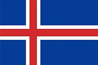
|
| Capital City | Reykjavik |
| 64 09 N, 21 57 W | |
| Total Area | 103,000.00 km2 |
| Land Area | 100,250.00 km2 |
| Water Area | 2,750.00 km2 |
| Population | 361,313 |
| Currency | Icelandic kronur (ISK) |
| GDP | $24.19 Billion |
| GDP Per Capita | $66,944.83 |
This page was last updated on December 15, 2023