Where is Lucas County, Ohio?
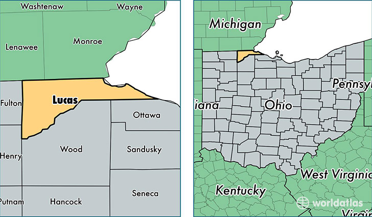
Lucas County is a county equivalent area found in Ohio, USA. The county government of Lucas is found in the county seat of Toledo.
With a total 1,543.31 sq. km of land and water area, Lucas County, Ohio is the 1756th largest county equivalent area in the United States. Home to 435,286 people, Lucas County has a total 201580 households earning 41556 on average per year.
Lucas County, Ohio offers the following attraction to visitors: Toledo Museum of Art
Lucas County, Ohio - Quick Facts
| FIPS Code | 39095 |
| Area Codes | 419 |
| Time Zone | EST |
| Major Cities | Toledo (population: 314,208), Sylvania (population: 31,947), Maumee (population: 27,040), Oregon (population: 20,692), Holland (population: 16,288), Waterville (population: 7,547), Whitehouse (population: 6,724), Curtice (population: 4,337), Monclova (population: 3,559), Berkey (population: 1,084) |
| Land Area | 168,065 sq miles |
| Water Area | 341 sq miles |
| Household Income | $41,556 |
| Housing Units | 201,580 |
| Median Home Value | $108,700 |
| High School Grads | 88% of population |
| Holders of Bachelors Degrees | 23% of population |
| Retail Spending | $12,493 per capita |
| Food & Accomodation Sales | $728,585 per capita |
| Universities and Colleges | The University of Toledo-Health Science Campus, Professional Skills Institute, Toledo Academy of Beauty Culture-South, University of Toledo |
This page was last updated on June 30, 2016.