Where is Clark County, Ohio?
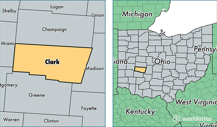
Clark County is a county equivalent area found in Ohio, USA. The county government of Clark is found in the county seat of Springfield.
With a total 1,042.54 sq. km of land and water area, Clark County, Ohio is the 2592nd largest county equivalent area in the United States. Home to 136,554 people, Clark County has a total 61083 households earning 43136 on average per year.
Clark County, Ohio - Quick Facts
| FIPS Code | 39023 |
| Area Codes | 937 |
| Time Zone | EST |
| Major Cities | Springfield (population: 100,993), New Carlisle (population: 16,839), Enon (population: 4,978), South Charleston (population: 4,689), Medway (population: 3,851), South Vienna (population: 3,516), North Hampton (population: 423), Tremont City (population: 371), Donnelsville (population: 290), Catawba (population: 269) |
| Land Area | 52,724 sq miles |
| Water Area | 397 sq miles |
| Household Income | $43,136 |
| Housing Units | 61,083 |
| Median Home Value | $106,400 |
| High School Grads | 86% of population |
| Holders of Bachelors Degrees | 18% of population |
| Retail Spending | $9,977 per capita |
| Food & Accomodation Sales | $173,143 per capita |
This page was last updated on June 30, 2016.