Where is Union County, Iowa?
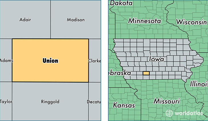
Union County is a county equivalent area found in Iowa, USA. The county government of Union is found in the county seat of Creston.
With a total 1,102.81 sq. km of land and water area, Union County, Iowa is the 2463rd largest county equivalent area in the United States. Home to 12,516 people, Union County has a total 5902 households earning 44838 on average per year.
Union County, Iowa - Quick Facts
| FIPS Code | 19175 |
| Area Codes | 641 |
| Time Zone | CST |
| Major Cities | Creston (population: 9,625), Afton (population: 1,751), Lorimor (population: 966), Thayer (population: 283), Shannon City (population: 274), Cromwell (population: 105) |
| Land Area | 4,832 sq miles |
| Water Area | 424 sq miles |
| Household Income | $44,838 |
| Housing Units | 5,902 |
| Median Home Value | $91,600 |
| High School Grads | 92% of population |
| Holders of Bachelors Degrees | 17% of population |
| Retail Spending | $12,759 per capita |
| Food & Accomodation Sales | $11,160 per capita |
This page was last updated on June 30, 2016.