Where is Cobb County, Georgia?
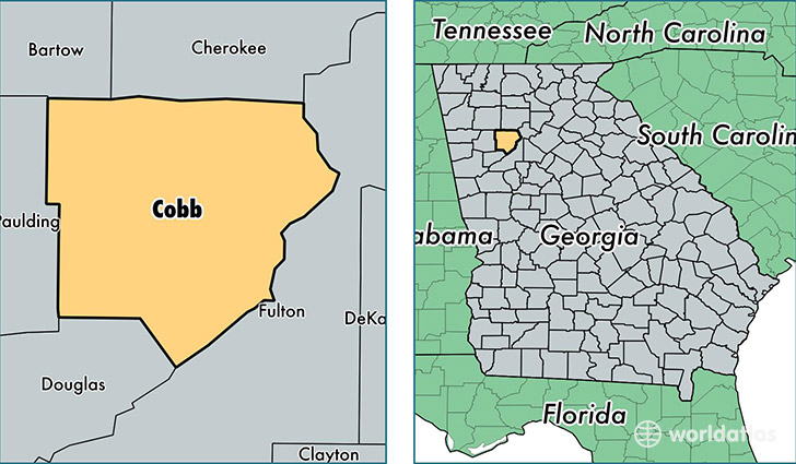
Cobb County is a county equivalent area found in Georgia, USA. The county government of Cobb is found in the county seat of Marietta.
With a total 892.3 sq. km of land and water area, Cobb County, Georgia is the 2749th largest county equivalent area in the United States. Home to 730,981 people, Cobb County has a total 290179 households earning 63920 on average per year.
Cobb County, Georgia offers the following attractions to visitors: Six Flags Over Georgia, Kennesaw Mountain NB Park
Cobb County, Georgia - Quick Facts
| FIPS Code | 13067 |
| Area Codes | 770 |
| Time Zone | EST |
| Major Cities | Marietta (population: 310,813), Kennesaw (population: 95,251), Smyrna (population: 77,943), Powder Springs (population: 61,957), Acworth (population: 55,765), Austell (population: 45,745), Mableton (population: 38,131), Atlanta (population: 18,827) |
| Land Area | 282,233 sq miles |
| Water Area | 340 sq miles |
| Household Income | $63,920 |
| Housing Units | 290,179 |
| Median Home Value | $196,700 |
| High School Grads | 91% of population |
| Holders of Bachelors Degrees | 44% of population |
| Retail Spending | $15,157 per capita |
| Food & Accomodation Sales | $1,393,471 per capita |
| Universities and Colleges | Chattahoochee Technical College, Roffler Moler Hairstyling College, Cobb Beauty College Inc, Empire Beauty School-Kennesaw |
This page was last updated on June 30, 2016.