Where is Merced County, California?
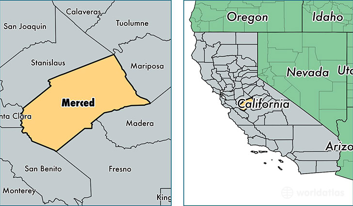
Merced County is a county equivalent area found in California, USA. The county government of Merced is found in the county seat of Merced.
With a total 5,124.31 sq. km of land and water area, Merced County, California is the 322nd largest county equivalent area in the United States. Home to 266,353 people, Merced County has a total 83840 households earning 42591 on average per year.
Merced County, California - Quick Facts
| FIPS Code | 6047 |
| Area Codes | 209 |
| Time Zone | PST |
| Major Cities | Merced (population: 100,189), Los Banos (population: 39,763), Atwater (population: 38,016), Livingston (population: 15,850), Winton (population: 13,406), Delhi (population: 13,349), Dos Palos (population: 9,831), Gustine (population: 9,169), Hilmar (population: 7,510), Planada (population: 5,111) |
| Land Area | 102,839 sq miles |
| Water Area | 1,935 sq miles |
| Household Income | $42,591 |
| Housing Units | 83,840 |
| Median Home Value | $146,400 |
| High School Grads | 67% of population |
| Holders of Bachelors Degrees | 13% of population |
| Retail Spending | $8,233 per capita |
| Food & Accomodation Sales | $219,430 per capita |
This page was last updated on June 30, 2016.