Pennington County, SD, USA
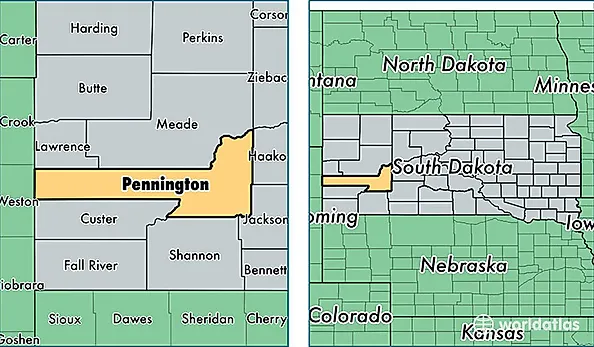
Pennington County is a county equivalent area found in South Dakota, USA. The county government of Pennington is found in the county seat of Rapid City.
With a total 7,211.29 sq. km of land and water area, Pennington County, South Dakota is the 203rd largest county equivalent area in the United States. Home to 108,242 people, Pennington County has a total 45906 households earning 50833 on average per year.
Pennington County, South Dakota offers the following attractions to visitors: Minuteman Missile NHS, Mount Rushmore NMEM
Pennington County, South Dakota - Quick Facts
| FIPS Code | 46103 |
| Area Codes | 605 |
| Time Zone | MST |
| Major Cities | Rapid City (population: 93,684), Box Elder (population: 6,418), Hermosa (population: 2,280), Hill City (population: 2,180), New Underwood (population: 1,248), Wall (population: 1,148), Keystone (population: 872), Quinn (population: 236), Wasta (population: 195), Caputa (population: 167) |
| Land Area | 41,792 sq miles |
| Water Area | 2,776 sq miles |
| Household Income | $50,833 |
| Housing Units | 45,906 |
| Median Home Value | $156,100 |
| High School Grads | 92% of population |
| Holders of Bachelors Degrees | 28% of population |
| Retail Spending | $20,388 per capita |
| Food & Accomodation Sales | $286,549 per capita |