Where is Garfield County, Colorado?
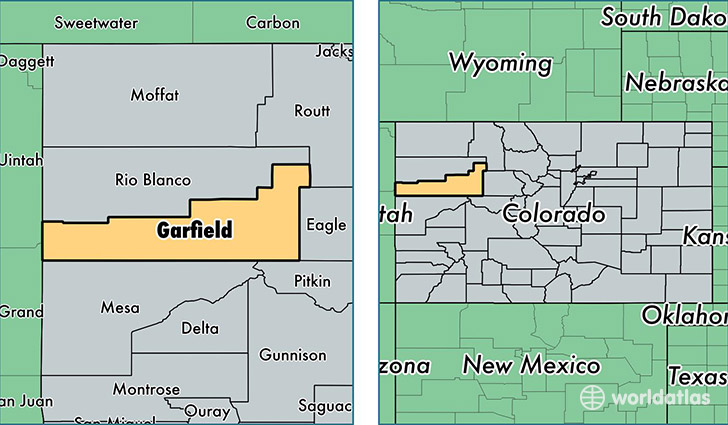
Garfield County is a county equivalent area found in Colorado, USA. The county government of Garfield is found in the county seat of Glenwood Springs.
With a total 7,655.9 sq. km of land and water area, Garfield County, Colorado is the 190th largest county equivalent area in the United States. Home to 57,461 people, Garfield County has a total 23239 households earning 57022 on average per year.
Garfield County, Colorado - Quick Facts
| FIPS Code | 8045 |
| Area Codes | 970 |
| Time Zone | MST |
| Major Cities | Glenwood Springs (population: 15,596), Carbondale (population: 15,318), Rifle (population: 13,137), New Castle (population: 7,175), Parachute (population: 6,016), Silt (population: 4,953) |
| Land Area | 22,186 sq miles |
| Water Area | 2,948 sq miles |
| Household Income | $57,022 |
| Housing Units | 23,239 |
| Median Home Value | $302,700 |
| High School Grads | 85% of population |
| Holders of Bachelors Degrees | 27% of population |
| Retail Spending | $22,367 per capita |
| Food & Accomodation Sales | $161,174 per capita |
This page was last updated on June 30, 2016.