Maps of Jamaica

Jamaica, a Caribbean island nation, lies approximately 90 miles (145 kilometers) south of Cuba and about 119 miles (191 kilometers) west of Hispaniola, the island housing the nations of Haiti and the Dominican Republic. The Caribbean Sea surrounds Jamaica, encapsulating its 10,990 km2 (4,240 mi2) of landmass.
The island of Jamaica is conventionally divided into three primary geographic regions: the Coastal Plains, the Limestone Plateau, and the Blue Mountains.
The Coastal Plains, as the name suggests, are found along the coastline of Jamaica, particularly expansive in the south. This region's characteristic low, flat lands give way to gently sloping hills as one moves inland. The Coastal Plains harbor a significant portion of the island's population due to its arable land and accessibility to the sea. Key cities such as Kingston and Montego Bay are located within this region. However, the plains are not uniform and feature a variety of ecosystems, including mangrove swamps, wetlands, and sandy beaches.
The Limestone Plateau: Circling the Coastal Plains and covering a large part of Jamaica is the Limestone Plateau, also known as the Karst region. This area exhibits a rolling topography interrupted by sinkholes, caverns, and disappearing rivers - typical features of limestone landscapes. The plateau also presents raised hillocks and sharp conical hills known as "cockpits". This region is predominantly rural, supporting a population largely dependent on agriculture. Despite the less fertile soil compared to the Coastal Plains, farmers in the area adapt by growing crops such as yams, sweet potatoes, and citrus fruits that can thrive in the given conditions.
The Blue Mountains: Dominating the eastern part of Jamaica are the Blue Mountains, the island's most elevated and rugged terrain, where forests are abundant. The Blue Mountain Peak, the highest point on the island, stands at an impressive 2,256 meters (7,402 feet). Its lower slopes are extensively cultivated with coffee, an important export crop for Jamaica. The area's high rainfall and cooler temperatures differentiate it climatically from the other regions.
Bodies of Water: Jamaica possesses a network of rivers and streams, the majority of which are short and swift due to the country's hilly terrain. Two of the largest rivers include the Black River in the west and the Rio Minho. Despite their size, most Jamaican rivers are not navigable due to their fast currents and rocky courses.
Islands: While Jamaica itself is an island, it also encompasses several smaller offshore islands and cays. The largest of these, the typically uninhabited Morant Cays and the Pedro Cays, are located to the south of the island. These smaller land masses are important for fishing activities and serve as habitats for a variety of seabirds and marine life.
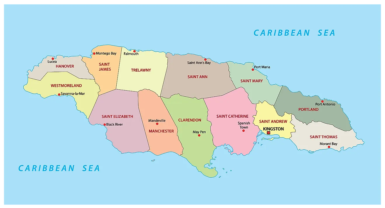
Jamaica is divided into 14 parishes. In alphabetical order, the parishes are: Clarendon, Hanover, Kingston, Manchester, Portland, Saint Andrew, Saint Ann, Saint Catherine, Saint Elizabeth, Saint James, Saint Mary, Saint Thomas, Trelawny and Westmoreland.
Covering an area of 10,990 sq. km, Jamaica is the 3rd largest Caribbean island. It is also the 3rd most populous country in America and the 4th most populous Caribbean nation. Located on the south eastern part of the island is Kingston – the capital and the largest city of Jamaica. It is a major port and an important business center of the country. The Kingston Harbour is the 7th largest natural harbour in the whole world.
Where is Jamaica?

Jamaica is a large island nation located in the west-central Caribbean in the Greater Antilles archipelago. It is positioned both in the Northern and Western hemispheres of the Earth. Jamaica is situated to the south of Cuba; to the west of Hispaniola Islands (Haiti & the Dominican Republic) and to the northwest of Cayman Islands. It is surrounded by the Caribbean Sea.
Regional Maps: Map of North America
Outline Map of Jamaica


Key Facts
| Legal Name | Jamaica |
|---|---|
| Flag |
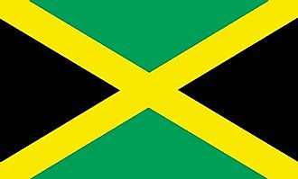
|
| Capital City | Kingston |
| 18 00 N, 76 48 W | |
| Total Area | 10,991.00 km2 |
| Land Area | 10,831.00 km2 |
| Water Area | 160.00 km2 |
| Population | 2,948,279 |
| Largest City |
Kingston (597,124) |
| Currency | Jamaican dollars (JMD) |
| GDP | $16.46 Billion |
| GDP Per Capita | $5,582.26 |
This page was last updated on August 2, 2023