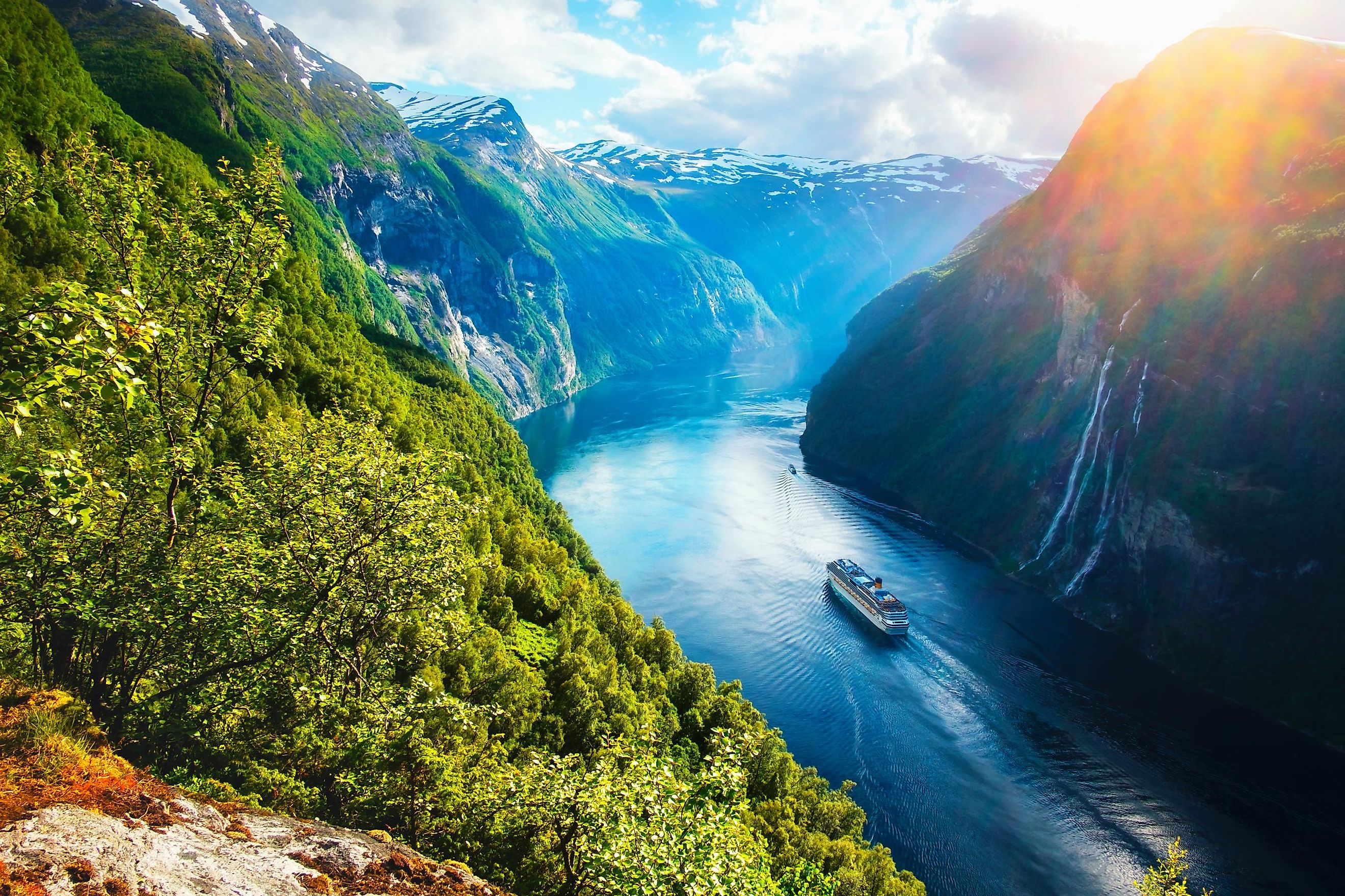
Scandinavian Peninsula
The Scandinavian region of Northern Europe comprises Norway, Denmark, and Sweden. Mainland Sweden and Norway are located on the Scandinavian Peninsula, which also includes Finland’s northwestern portion and part of northwestern Russia.
The peninsula derives its name from the term “Scandinavia,” derived from “Scania,” a region previously considered part of Denmark but now a portion of Sweden. It is the largest peninsula in Europe by area, larger than the Iberian, Italian, and Balkan peninsulas. During the Ice Age, the Scandinavian Peninsula was joined directly by land due to the significant drop in the Atlantic Ocean’s sea level, which caused the surrounding water bodies to disappear.
Where Is The Scandinavian Peninsula?

The Scandinavian Peninsula is located in Northern Europe and joined to the continental mainland (Russia) to the north. It is bordered to the east by southern Finland across the Gulf of Bothnia, southeast by the Baltic Sea, south by Denmark with the Øresund Strait in between, northwest by the Kola Peninsula, and west by Iceland across the Norwegian Sea. The North Sea separates the peninsula from the Shetland Islands to the southwest, and it is bordered to the north by the Barents Sea.
Geography

The Scandinavian Peninsula is about 1,850 km long, with varying widths of 370-805 km. The peninsula covers about 750,000 km2 and is shared mainly by two countries, Sweden and Norway, with Finland’s and Russia’s northwestern portions also extending into the peninsula. Sweden and Norway share the eastern and western sides respectively and are separated by the Scandinavian Mountain Range.
The Scandinavian Peninsula is dominated mainly by mountain masses that slope towards the Baltic Sea. Glittertinden was previously the highest elevation on the peninsula at 2,470 m above sea level. However, the summit's partial glacier melting reduced its height by 5 m, making it the region's second-highest elevation. At 2,469 meters, Galdhøpiggen is currently the highest elevation on the peninsula. Jostedal Glacier, mainland Europe’s largest glacier, is located on these mountains.
Human Settlement

The peninsula’s northern portion lies within or near the Arctic Circle, making it one of the coldest places in Europe. Thus, the northern region may have been uninhabited until later on in human history. The southern areas, including Denmark, may have been inhabited as early as 12,000 years ago, mainly by reindeer hunters. Later, the Sami people, also known as Laplanders or Lapps, occupied the central and northern parts. The Norwegians were the first people to inhabit the peninsula, followed by the Danes, who mainly occupied southeastern Norway and western and southern Sweden.
The Scandinavian Peninsula countries have existed as distinct nations for close to 1,000 years, but the boundaries between them were only formalized later on. The Norwegian and Swedish boundaries were defined in 1751, and the Swedish-Finnish border was marked in 1809 after intense negotiations. The Norwegian-Russian districts were partitioned in 1826 and Finland ceded its territory of the Barents Sea’s coast to Russia in 1944. Between 1940 and 1945, Nazi Germany (through Wehrmacht) had occupied much of the peninsula, especially Norway, and, jointly with the Finnish Army, invaded the Soviet Union.