Maps of Croatia

Croatia is a European country occupying an area of 56,594 km2(21,851 sq mi). As observed on the physical map of Croatia, despite its relatively small size, the landscape is considerably diverse.
It is made up of fertile and mostly flat plains in the north, and low mountains and highlands along the coast.
The Dinaric Alps and a few smaller mountain ranges (Velebit and Velika Kapela) slice through the country, with the highest point rising to 6,005 ft. (1,831m). The highest point has been marked on the map by a yellow upright triangle.
Along the Dalmatian coast, as well as on most of Croatia's offshore islands, the land is hilly, rocky and steep.
Natural water sources are numerous, and the country's biggest lake, Lake Vrana, extends over 12 sq. miles (30 sq. km). However, the Plitvice lakes are the most famous and are composed of a group of 16 different small lakes connected by waterfalls.
Europe's second-largest river, the Danube, forms the far northeastern border with Serbia. Other major rivers include the Drava, Krka and Save.
Counties of Croatia Map

Croatia (officially, the Republic of Croatia) is administratively divided into 20 counties (zupanije, zupanija - singular) and 1 city with special county status (grad - singular). In alphabetical order,the counties are: Bjelovarsko-Bilogorska(Bjelovar-Bilogora), Brodsko-Posavska (Brod-Posavina), Dubrovacko-Neretvanska (Dubrovnik-Neretva), Istarska (Istria), Karlovacka (Karlovac), Koprivnicko-Krizevacka (Koprivnica-Krizevci), Krapinsko-Zagorska (Krapina-Zagorje), Licko-Senjska (Lika-Senj), Medimurska (Medimurje),Osjecko-Baranjska (Osijek-Baranja), Pozesko-Slavonska (Pozega-Slavonia), Primorsko-Goranska (Primorje-Gorski Kotar), Sibensko-Kninska (Sibenik-Knin), Sisacko-Moslavacka (Sisak-Moslavina), Splitsko-Dalmatinska (Split-Dalmatia), Varazdinska (Varazdin), Viroviticko-Podravska (Virovitica-Podravina),Vukovarsko-Srijemska (Vukovar-Syrmia), Zadarska (Zadar), and Zagrebacka (Zagreb county). Zagreb is a city with special county status.
The counties are further subdivided into 128 cities and 428 municipalities. The city of Zagreb is subdivided into 17 city districts.
Situated along the Sava River, at the southern slopes of the Medvednica Mountains, in the north western part of the country is, Zagreb – the capital and the largest city of Croatia. Zagreb is the country’s main administrative, cultural, industrial, economic and transport hub.
Where is Croatia?

Croatia is located in the south eastern region of the European Continent, on the north western part of the Balkan Peninsula. It is geographically positioned both in the Northern and Eastern hemispheres of the Earth. Croatia is bordered by 5 Nations: by Slovenia in the northwest; Hungary in the northeast; Serbia in the east; Bosnia and Herzegovina and Montenegro in the southeast. It is also bounded by the Adriatic Sea in the west. Croatia shares a maritime border with Italy.
Croatia Bordering Countries: Montenegro, Hungary, Serbia, Bosnia And Herzegovina, Slovenia.
Regional Maps: Map of Europe
Outline Map of Croatia

The blank outline map above represents the mainland territory and islands of Croatia, a country in Europe. The map can be downloaded, printed, and used for map-pointing work or coloring.

The outline map above is of Croatia, a country occupying an area of 56,594 km2(21,851 sq mi) in Europe. The map shows mainland Croatian territory along with its numerous islands on the Adriatic Sea.
Key Facts
| Legal Name | Republic of Croatia |
|---|---|
| Flag |
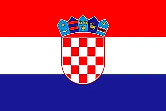
|
| Capital City | Zagreb |
| 45 48 N, 16 00 E | |
| Total Area | 56,594.00 km2 |
| Land Area | 55,974.00 km2 |
| Water Area | 620.00 km2 |
| Population | 4,067,500 |
| Largest City |
Zagreb (684,114) |
| Currency | Kuna (HRK) |
| GDP | $60.42 Billion |
| GDP Per Capita | $14,853.24 |
This page was last updated on February 25, 2021