Maps of Albania

Albania is a sovereing country occupying an area of 28,748 sq. km (11,100 sq mi) in southeast Europe. As observed on the physical map of Albania, the country exhibits significant diversity in topography. The landscape ranges from snow-capped mountains to warm and sunny coastal areas along the Ionian and Adriatic seas.
From the broad and swampy coastal plain fronting the Adriatic Sea, the land rises into hills and mountains that makes up roughly 70% of the country's area. Marked on the map above are the major mountain ranges of Albania- the Albanian Alps, and the Korab and Pindus Mountains. The highest point is Mt. Karabit in the Korab mountains at 9,066 ft (2,764 m). The mountain is located on Albania's border with North Macedonia. A yellow triangle marks the position of this point on the map.
From the mountains, flowing inland toward the Adriatic Sea, are significant rivers like the Drin and Vlore. The three major lakes of Albania include Shkodra (shared with Montenegro), Ohrid and Prespa (both shared with Macedonia). Lake Ohrid is the deepest lake in the Balkans, and reaches depths of 935 ft (284 m). The lowest point in Albania is the Adriatic Sea at 0 m.
Counties of Albania Map

Albania (officially, the Republic of Albania) is divided into 12 counties (qarqe, sing. qark). The counties are: Berat, Diber, Durres, Elbasan, Fier, Gjirokaster, Korce, Kukes, Lezhe, Shkoder, Tirane and Vlore. The counties are subdivided into 61 municipalities and several smaller subdivisions.
Located in the heart of the country is, Tirana – the capital, the largest and the most populous city of Albania. It is the main administrative, financial and economic center of the country.
Where is Albania?

Albania is located in the south eastern region of the European continent, in the western part of the Balkan Peninsula. It is positioned both in the Northern and Eastern hemispheres of the Earth. Albania is bordered by 4 Nations: by Montenegro in the northwest; by Kosovo in the northeast; by North Macedonia in the east; and by Greece in the south and southeast. It is bounded by the Adriatic Sea in the west and the Ionian Sea in in the southwest. Albania shares its maritime borders with Italy, Greece and Montenegro.
Albania Bordering Countries: Macedonia, Greece, Montenegro.
Regional Maps: Map of Europe
Outline Map of Albania

The above blank outline map represents Albania, a country located in Southeastern Europe on the Balkan Peninsula. The above map can be downloaded, printed and used for geographical educational purposes.

The above outline map represents the small mountainous country of Albania in the Balkan Peninsula.
Key Facts
| Legal Name | Republic of Albania |
|---|---|
| Flag |
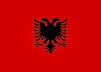
|
| Capital City | Tirana (Tirane) |
| 41 19 N, 19 49 E | |
| Total Area | 28,748.00 km2 |
| Land Area | 27,398.00 km2 |
| Water Area | 1,350.00 km2 |
| Population | 2,854,191 |
| Largest City |
Tiranë (Tirana) (520,059) |
| Currency | Leke (ALL) |
| GDP | $15.28 Billion |
| GDP Per Capita | $5,352.86 |
This page was last updated on February 24, 2021