Maps of Myanmar

Myanmar (formerly Burma) occupies an area of 676,578 sq. km in the northwesternmost part of mainland Southeast Asia. One of the largest nations in this region, Myanmar borders the five other nations of India, Bangladesh, China, Thailand, and Laos. Myanmar's geography is mostly made up of thick tropical rainforests, tall mountains, and surging river valleys.
The Himalayan mountain range does surprisingly sneak into the north of Myanmar. Marked on the physical map above by a yellow triangle, is the country's highest point, Hkakabo Razi at 19,296 feet (5,881 m). The mountain ranges of the north mostly run in the north-south direction. The elevation of the country gradually rises from the sea level at the river deltas of the Irrawaddy and Sittang river systems to Mount Kkakabo in the north.
The Irrawaddy River system dominates the country. This mighty river is responsible for giving Myanmar countless valleys and the river's massive delta in the south. The course of the Irrawaddy River can be observed on the map above. The low-lying floodplains in the south are the ideal place to grow crops. Many of Myanmar's largest cities are towns can be found along the banks of the Irrawaddy River including the capital city of Nay Pyi Taw.
The Mergui Archipelago, located in the far south contains over 800 islands, most of them completely uninhabited. The islands are located just off the southern coast along the Indian Ocean and the Andaman Sea. These bodies of water give Myanmar access to global trade but this does come at a cost. Each year the nation is wracked by a series of devastating monsoons.
Regions of Myanmar Map

Myanmar (officially, the Republic of the Union of Myanmar) is divided into 7 regions (taing), 7 states (pyine) and 1 union territory. In alphabetical order, the regions of Myanmar are: Ayeyarwady (Irrawaddy), Bago, Magway, Mandalay, Sagaing, Tanintharyi and Yangon (Rangoon). The states are: Chin, Kachin, Kayah, Kayin, Mon, Rakhine and Shan. Nay Pyi Taw (Naypyidaw) is the union territory in Myanmar.
With an area of 676,578 sq. km, Myanmar is the 10th largest country in the Asian continent and the largest country in Southeast Asia. Located in a mountain-framed spot in north-central Myanmar is Naypyidaw – the capital and the third-largest city of Myanmar. Located in southern Myanmar, Yangon (Rangoon) is the largest city of Myanmar. With over a population of 5 million people, Yangon is the most populous city as well as an important commercial center of Myanmar.
Where is Myanmar?

Myanmar is a Southeast Asian country. It is situated in the Northern and Eastern hemispheres of the Earth. Myanmar is bordered by the Indian states of Mizoram, Manipur, Nagaland and Arunachal Pradesh and by the Chittagong division of Bangladesh in the northwest; by Tibet Autonomous Region and Yunnan province of China in the north and northeast; by Laos in the east and by Thailand in the southeast. Myanmar is bounded by the Andaman Sea in the south and by the Bay of Bengal in the southwest.
Myanmar Bordering Countries: India, China, Bangladesh, Thailand, Laos.
Regional Maps: Map of Asia
Outline Map of Myanmar


Key Facts
| Legal Name | Republic of the Union of Myanmar |
|---|---|
| Flag |
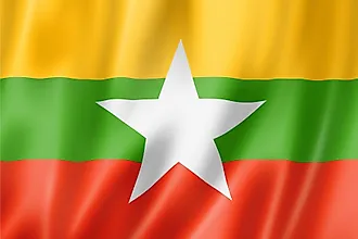
|
| Capital City | Rangoon (Yangon); note - Nay Pyi Taw is the administrative capital |
| 16 48 N, 96 09 E | |
| Total Area | 676,578.00 km2 |
| Land Area | 653,508.00 km2 |
| Water Area | 23,070.00 km2 |
| Population | 54,045,420 |
| Currency | Kyats (MMK) |
| GDP | $76.09 Billion |
| GDP Per Capita | $1,407.81 |
This page was last updated on December 28, 2023