Maps of Kazakhstan

Kazakhstan is a country that stretches from Central Asia to Eastern Europe and occupies an area of 2,724,900 sq. km.
As seen on the physical map of Kazakhstan above, the country extends from the Caspian Sea in the west to the Altay Mountains in the east.
A vast stretch of land accounting for nearly one-third of the country's area is the Kazakh Steppe. It is the largest dry steppe area in the world covering 804,500 sq. km.
Kazakhstan is mountainous along its far eastern and southeastern borders, where much of the forested Altai and the Tian Shan ranges remain snowcapped throughout the year and with many elevated peaks exceeding 6,500 meters.
Kazakhstan's highest peak is Khan Tengri (marked on the map by a yellow upright triangle), whose summit reaches 22,949 ft. (6,995 m).
Along the edges of the landlocked Caspian Sea, the land dips way below sea level in some areas. In the west along its border with the Russian Federation, rolling prairies and forests dominate the landscape.
The most important rivers include the Ishim, Irtush, Syr Dayra, Tobol, and Ural. The Caspian Sea and the Aral Sea, and lakes Alakal, Balkhash, Tengiz, and Zaysan are the largest bodies of water.
The lowest point of Kazakhstan (marked by a yellow inverted triangle on the map) is the deepest point of the Karagiye depression at 132 m (433 ft) below sea level.
Regions of Kazakhstan Map

Kazakhstan (officially, Republic of Kazakhstan) is divided into 14 administrative regions (Kazakh: oblystar/oblys) and 4 cities. In alphabetical order, the regions are: Akmola, Aktobe, Almaty, Atyrau, East Kazakhstan, Jambyl, Karaganda, Kostanay, Kyzylorda, Mangystau, North Kazakhstan, Pavlodar, Turkistan and West Kazakhstan. The cities are: Almaty, Baikonur, Nur-Sultan, Shymkent. The regions are further subdivided into districts (Kazakh: aỷdan).
With an area of 2,724,900 sq. km, Kazakhstan is the world’s largest landlocked country and the ninth largest country in the world. It is also the most economic dominant Nation of Central Asia. Nur-Sultan (known as Astana between 1998 and 2019) is the capital city and is located on the banks of the Ishim River in the country's northern part. With a population of over a million inhabitants, it is the second largest city in Kazakhstan. Almaty located in the mountainous region of southern Kazakhstan, is the largest city in the country, with a population of over two million inhabitants. Almaty is the major commercial and cultural centre, as well as the most populous and cosmopolitan city of Kazakhstan.
Where is Kazakhstan?

Kazakhstan is a transcontinental country with major parts in Central Asia and a small part in Eastern Europe. It is located in the Northern and Eastern hemispheres of the Earth (at the junction of Europe and Asia). It is bordered by 5 nations; the Russian Federation in the north and west; China in the east; Kyrgyzstan, Uzbekistan and Turkmenistan in the south. The Aral Sea is located along the southern border. The Caspian Sea is situated along the western border.
Kazakhstan Bordering Countries: Russia, Turkmenistan, China, Kyrgyzstan, Uzbekistan.
Regional Maps: Map of Asia
Outline Map of Kazakhstan

The above map is of the world's largest landlocked nation, Kazakhstan. The map can be downloaded, printed, and used for coloring and map-pointing activities.

The above map represents the transcontinental nation of Kazakhstan in Eurasia. It is the world's largest landlocked country.
Key Facts
| Legal Name | Republic of Kazakhstan |
|---|---|
| Flag |
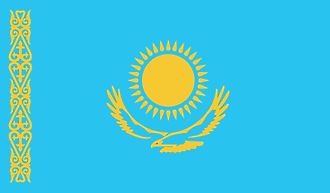
|
| Capital City | Nur-Sultan |
| 51 10 N, 71 25 E | |
| Total Area | 2,724,900.00 km2 |
| Land Area | 2,699,700.00 km2 |
| Water Area | 25,200.00 km2 |
| Population | 18,513,930 |
| Major Cities |
|
| Currency | Tenge (KZT) |
| GDP | $180.16 Billion |
| GDP Per Capita | $9,731.15 |
This page was last updated on February 24, 2021