Maps of Bahrain

Bahrain is an archipelagic nation with a total territory of around 780 sq. km in the Persian Gulf. The main island of Al Bahrayn accounts for about 78% of the country's territory. Many important petroleum fields of the Middle East surround this island. 33 additional islands are also part of the country. Although Bahrain technically does not share any border with other nations, it is connected to Saudi Arabia by a causeway to the west of the country.
The Persian Gulf is the lowest point of the country (0 m) and extensive coral reefs cover the northern part of the island. As observed on the physical map of Bahrain above, nearly 92% of Bahrain is a desert with low-lying rocky and sandy plains. Coastal salt marshes are common in the central and southern reaches, and there are no significant rivers or lakes.
Jabal ad Dukham, an escarpment that sits within the interior of Bahrain is the highest point in the country, reaching 400 ft. (122 m). Its position has been marked on the map by a yellow upright triangle. The rest of Bahrain is largely flat and consists of sand dunes and rocky-arid terrain.
Additional islands are a part of Bahrain as well including Umm as Sabaan, Nabih Saleh, and Jidda Island. Freshwater springs and date palm groves dot the landscape of Nabih Saleh, while Jidda's rocky terrain plays host to a state prison converted into a holiday resort. The remaining uninhabited islands serve as nesting sites for migratory birds.
Governorates of Bahrain Map

Bahrain (officially, The Kingdom of Bahrain) is divided into 4 governorates (muhafazat, sing. muhafazah). In alphabetical order, these governorates are: Asimah (capital), Janubiyah (southern), Muharraq and Shamaliyah (northern).
With an area of 780 sq. km, Bahrain is the third-smallest nation in Asia. Located at the north-eastern edge of Bahrain Island in the Persian Gulf, is Manama – the capital and largest city of Bahrain. Manama is the country’s chief port and also an important economic and commercial center in the Middle East.
Where is Bahrain?

Bahrain is an island nation in the Middle East. It is situated in the Northern and eastern hemispheres of the Earth. The archipelago consists of the main island Al Bahrayn and other small islands. Bahrain is located in the Persian Gulf, to the east of Saudi Arabia and to the north of Qatar. Bahrain shares its maritime borders with Iran, Qatar and Saudi Arabia.
Regional Maps: Map of Asia
Outline Map of Bahrain

The above outline map represents the country of Bahrain in the Middle East. It shows the main island of the country, Al Bahrayn (the largest island) and surrounding smaller islands. The map can be downloaded for free, printed, and used for coloring or educational purpose.

The above map represents the archipelagic Middle Eastern nation of Bahrain.
Key Facts
| Legal Name | Kingdom of Bahrain |
|---|---|
| Flag |
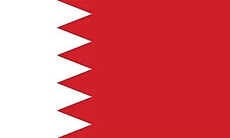
|
| Capital City | Manama |
| 26 14 N, 50 34 E | |
| Total Area | 760.00 km2 |
| Land Area | 760.00 km2 |
| Water Area | N/A |
| Population | 1,641,172 |
| Largest City |
Al-Manamah (Manama) (708,882) |
| Currency | Bahraini dinars (BHD) |
| GDP | $38.57 Billion |
| GDP Per Capita | $23,503.98 |
This page was last updated on December 27, 2023