Maps of Afghanistan

About the size of the U.S. State of Texas, Afghanistan occupies an area of 647,230 km2 (249,900 sq mi) in Southern Asia.
As observed on the physical map of the country above, most of Afghanistan is a rugged, inhospitable mountainous landscape. More than 50% of the total land area lies above 6,500 ft. (2,000 m). It all culminates in the high peaks of the Hindu Kush, where extensions of the Pamir Mountains, Karakorum Mountains and the Himalayas all come together.
Afghanistan's highest point is Mt. Nowshak (marked on the map by a yellow triangle) which peaks at 24,446 ft. (7,485 m).
In the north, a fertile plain front the Amu Darya River. In the south, below the mountains, rolling desert and scattered salt flats cover the land.
Afghanistan is drained by numerous rivers; significant ones include the Amu Darya, Hari, Helmand, and the Kabul - directly east of the capital city, flowing down into the Indus River in Pakistan.
In 2009 Afghanistan designated a portion of the Hindu Kush Mountains, known as Band-e Amir, their first national park. The park contains six deep blue lakes, Band-e Gholaman, Band-e Qambar, Band-e Haibat, Band-e Panir, Band-e Pudina and Band-e Zulfiqar, all of which are separated by natural dams.
Provinces of Afghanistan Map

Afghanistan (officially, The Islamic Republic of Afghanistan) is divided into 34 administrative provinces (welayat). In alphabetical order, the 34 provinces are: Badakhshan, Badghis, Baghlan, Balkh, Bamyan, Daykundi, Farah, Faryab, Ghazni, Ghor, Helmand, Herat, Jowzjan, Kabul, Kandahar, Kapisa, Khost, Kunar, Kunduz, Laghman, Logar, Nangarhar, Nimroz, Nuristan, Paktika, Paktiya, Panjshir, Parwan, Samangan, Sar-e-Pul, Takhar, Uruzgan, Wardak and Zabul. These provinces are further subdivided into several districts.
Located in the east-central part of the country, Kabul – is the capital and largest city of Afghanistan. Kabul’s location at an altitude of 1790m, in a narrow valley of the Hindu Kush Mountains – makes it one of the highest capitals in the world. Kabul is the only city in Afghanistan, with populations over a million. Kabul is the country’s largest urban center as well as the political, cultural and economic hub of Afghanistan.
Where is Afghanistan?

Afghanistan is a landlocked mountainous country in Southern Asia. It is situated in the Northern and Eastern hemispheres of the Earth. It is bordered by six nations – by Pakistan in the east and south; Iran in the west; Turkmenistan, Uzbekistan and Tajikistan in the north and China in the northeast.
Afghanistan Bordering Countries: Iran, Turkmenistan, China, Pakistan, Tajikistan, Uzbekistan.
Regional Maps: Map of Asia
Outline Map of Afghanistan


Key Facts
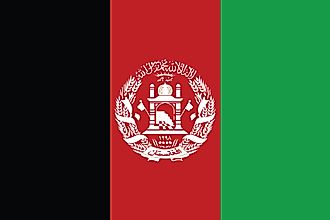
| Legal Name | Islamic Republic of Afghanistan |
|---|---|
| Flag |
|
| Capital City | Kabul |
| 34 31 N, 69 11 E | |
| Total Area | 652,230.00 km2 |
| Land Area | 652,230.00 km2 |
| Water Area | N/A |
| Population | 38,041,754 |
| Major Cities |
|
| Currency | Afghanis (AFA) |
| GDP | $19.10 Billion |
| GDP Per Capita | $502.12 |
This page was last updated on March 7, 2023