Maps of Sao Tome and Principe

São Tomé and Príncipe, one of the smallest African countries, is located on the Gulf of Guinea in the Atlantic Ocean. It has a total area of around 1,001 sq. km and a coastline of about 209 km. As observed in the physical map of the country, it has two major islands, São Tomé and Príncipe from where the name of the country is derived. These islands are separated by a distance of around 181.55 km and are surrounded by many smaller islands forming archipelagos. Being an island nation, it shares no land borders but is in close proximity to Gabon and Equatorial Guinea.
São Tomé is the largest island in the country and is located just above the equator as visible on the map above. It is more mountainous than Príncipe. The highest peak here (Pico de São Tomé) is at 2,024 m which is also the highest point in the country. The highest point on Príncipe is at 948 m. Both islands are part of a long-extinct volcanic range. At 0 m, the Atlantic Ocean is the lowest elevation in the country.
Rivers and lakes are nearly non-existent on each island but there is an abundance of small streams and creeks that wind across the country. São Tomé and Príncipe both have a generally wet and hot climate with the average yearly temperature being around 27 °C (80.6 °F) and with an average annual rainfall of 5,000 mm (196.9 in). The rainy season lasts between October to May.
Smaller islands observed on the map are Tinhosa Islands, Illheu das Cabras, and Illheu das Rolas. Tinhosa Islands are part of UNESCO's Island of Príncipe Biosphere Reserve. Illheu das Cabras is a small island with two hills and a lighthouse to the northeast of São Tomé. Illheu das Rolas, located off the southern tip of São Tomé is also an uninhabited island.
Districts of Sao Tome and Principe Map

São Tomé and Príncipe has six administrative districts. They are Água Grande, Cantagalo, Caué, Lembá, Lobata, and Mé-Zóchi. All of them are located on the island of São Tomé. The Príncipe island had only one district since 1980 called Pagué but in 1995, it was replaced by the Autonomous Region of Príncipe. With an area of 267 sq.km, Caué is the biggest district in the country but the least populous one. Covering only 16.5 sq.km, Água Grande is the country's smallest district but the most populated one. Its capital São Tomé is also the national capital.
Where is Sao Tome and Principe?

The island country of Sao Tome and Principe is located in the Gulf of Guinea off Central Africa's western equatorial coast. As observed in the location map, the country straddles the equator with territories on both sides of the equator. In terms of its longitudinal location, it is in the Eastern Hemisphere. It has two main islands Sao Tome and Principe, each surrounded by numerous small islands to form two archipelagos.
Regional Maps: Map of Africa
Outline Map of Sao Tome and Principe

The blank outline map of Sao Tome and Principe shows the two archipelagos of Sao Tome and Principe constituting the country. The map can be downloaded for free and used for educational purpose or coloring.

The outline map of Sao Tome and Principe shows the two archipelagos of Sao Tome and Principe constituting the country. Sao Tome, the largest island in the country, forms the southern archipelago while Principe is the northern one.
Key Facts
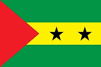
| Legal Name | Democratic Republic of Sao Tome and Principe |
|---|---|
| Flag |
|
| Capital City | Sao Tome |
| 0 20 N, 6 44 E | |
| Total Area | 964.00 km2 |
| Land Area | 964.00 km2 |
| Water Area | N/A |
| Population | 215,056 |
| Currency | Dobras (STD) |
| GDP | $429.02 Million |
| GDP Per Capita | $1,994.91 |
This page was last updated on December 17, 2023