Maps of Mozambique

Located along the South African coast, Mozambique occupies an area of 801,590 sq. km. Filled with rivers and other crucial waterways, Mozambique serves as a crucial point of contact with the outside world for many of its inland, landlocked neighbors. Mozambique borders six countries; Zimbabwe, Eswatini, South Africa, Zambia, Malawi, and Tanzania.
Monte Binga (marked on the map), peaking at 2,435 m, is the highest point of Mozambique; the Indian Ocean (0 m) is the lowest. To the north of the Zambezi River that runs almost through central Mozambique, a narrow coastline and bordering plateau slope upward into hills and a series of rugged highlands like Angonia Highlands and Lichinga Highlands (as shown on map) punctuated by scattered mountains.
South of the Zambezi River, the lowlands are much wider with scattered hills and mountains along its borders with South Africa, Swaziland, and Zambia. The country is drained by several significant rivers, with the Zambezi being the largest and most important. The Zambezi is in fact the fourth-longest river in Africa, and the largest flowing into the Indian Ocean from Africa. Other important rivers flowing in Mozambique include Limpopo, Licungo, Lurio, Rovuma, and others.
Lake Malawi (Nyasa) is the country's major lake. As seen on the map, it is located on Mozambique's border with Malawi. The Cahora Bassa is Africa's fourth-largest artificial lake. A small slice of Malawi's Lake Chiuta sits in Mozambique.
Provinces of Mozambique Map

Mozambique is divided into 10 provinces. In alphabetical order, these are as follows: Cabo Delgado, Gaza, Inhambane, Manica, Maputo, Nampula, Niassa, Sofala, Tete, Zambezia. The country also hosts one city, the Cidade de Maputo. The provinces are subdivided into 129 districts which, in turn, are divided into 405 Administrative Posts. The latter is divided into Localidades.
With an area of 129,056 sq. km, Niassa is the biggest province of Mozambique by area while Nampula is the most populous one.
Where is Mozambique?

Mozambique is a country in Southern Africa and is located in the Southern and Eastern Hemispheres of the Earth. It is bordered by six countries. These are Tanzania to the north, Zambia and Malawi to the northwest, and Zimbabwe to the west. South Africa and Eswatini border Mozambique to the southwest. The country also has a coastline on the Indian Ocean to the east. The island countries and territories of Madagascar, Comoros, and Mayotte are separated from Mozambique by the Mozambique Channel.
Mozambique Bordering Countries: Zambia, Zimbabwe, Eswatini, Tanzania, South Africa, Malawi.
Regional Maps: Map of Africa
Outline Map of Mozambique

The blank outline map of Mozambique can be downloard for free and used for coloring or for map-pointing activites as part of Geography education classes. The country is located in Southern Africa and the right arm of the country is bordered by the Indian Ocean. The fork of the Y shape of the country is formed by an extension of the territory of neighboring Malawi.

The outline map represents the mainland territory of the Southern African country of Mozambique. It also has several islands on the Indian Ocean to the east. The country's shape appears like a distorted Y.
Key Facts
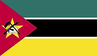
| Legal Name | Republic of Mozambique |
|---|---|
| Flag |
|
| Capital City | Maputo |
| 25 57 S, 32 35 E | |
| Total Area | 799,380.00 km2 |
| Land Area | 786,380.00 km2 |
| Water Area | 13,000.00 km2 |
| Population | 30,366,036 |
| Major Cities |
|
| Currency | Meticais (MZM) |
| GDP | $14.93 Billion |
| GDP Per Capita | $491.80 |
This page was last updated on January 31, 2024