Maps of Liberia

Located on the West African coast, Liberia covers an area of 111,369 sq. km.
Four physiographic regions run nearly parallel to the Atlantic coast of the country. As observed on Liberia's physical map, the elevation of the land gradually increases with distance from the coast.
The coastal plains are around 560 km long and 40 km wide and feature sandy beaches, lagoons, mangrove swamps, and some rocky outcrops.
Next is the region of rolling hills about 32 km wide and an average elevation of 90 m.
Beyond that is a dissected plateau with scattered mountains.
Finally, there is a mountainous highland region to the north hosting the country's highest point, the 1,440 m high Mount Wuteve, which has been marked on the map by an upright yellow triangle.
The lowest point of the country is the Atlantic Ocean at 0m.
The country's major rivers include the Mano River in the northwest and the Cavalla River in the southeast.
The Cavalla is the longest river in the nation at 320 mi (515 km). 15th-century Portuguese navigators named it for the cavalla (or horse mackerel) found at its mouth.
Additional rivers of note are the Lofa, St. Paul, St. John and Cestos River, all of which flow into the Atlantic.
Counties of Liberia Map

Liberia is divided into 15 counties which are subdivided into 90 and further into clans.
In alphabetical order, the 15 counties are Bomi, Bong, Gbarpolu, Grand Bassa, Grand Cape Mount, Grand Gedeh, Grand Kru, Lofa, Margibi, Maryland, Montserrado, Nimba, River Cess, River Gee, and Sinoe.
With an area of 11,551 sq. km, Nimba is the largest country and Montserrado is the most populous one.
The national capital of Monrovia is located in Montserrado.
Where is Liberia?

Liberia is a country in West Africa. It is located in the Northern and Western Hemispheres. The three countries of Sierra Leone, Guinea, and Ivory Coast bound Liberia to the northwest, north, and east respectively. The Atlantic Ocean borders Liberia to the south-southwest.
Liberia Bordering Countries: Guinea, Cote D'Ivoire, Sierra Leone.
Regional Maps: Map of Africa
Outline Map of Liberia


Key Facts
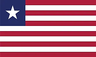
| Legal Name | Republic of Liberia |
|---|---|
| Flag |
|
| Capital City | Monrovia |
| 6 18 N, 10 48 W | |
| Total Area | 111,369.00 km2 |
| Land Area | 96,320.00 km2 |
| Water Area | 15,049.00 km2 |
| Population | 4,937,374 |
| Largest City |
Monrovia (1,678,020) |
| Currency | Liberian dollars (LRD) |
| GDP | $3.07 Billion |
| GDP Per Capita | $621.89 |
This page was last updated on February 24, 2021