Appalachian Mountains States
The Appalachian Mountains span over 2,000 miles across the eastern and northeastern parts of the United States, as well as into the Maritime provinces of eastern Canada. As far as the American portion, in approximate order from southwest to northeast, participating states include: Alabama, Georgia, Tennessee, South Carolina (only its extreme northeast border), North Carolina, Kentucky, Virginia, West Virginia, Ohio (just the slightest brush of its border), Maryland, Pennsylvania, New Jersey, New York, Connecticut, Massachusetts, Vermont, New Hampshire, and Maine. Because of some transitional gray areas and subrange semantics, certain authorities include Mississippi but exclude a few borderline states. In any case, this swath of the U.S. is blessed by a rolling, densely forested, and biologically diverse strip of wilderness that constitutes the oldest mountain range on the continent and is second only to the Rocky Mountains in terms of North America's longest. Let's explore this enthralling region and learn a bit more about the (major) states that comprise it.
Jump To:
- Alabama
- Georgia
- Tennessee
- The Carolinas
- Kentucky
- Virginia
- West Virginia
- Maryland
- Pennsylvania
- New Jersey
- New York
- Connecticut
- Massachusetts
- Vermont
- New Hampshire
- Maine
Alabama

Highest Point: Cheaha Mountain (2,407 feet)
Northern Alabama represents the southwesternmost section of the Appalachian Mountains. One of the best ways to get a feel for the area is to drive the 80-mile Appalachian Highlands Scenic Byway. This will take motorists through Cheaha State Park, the Talladega National Forest, and the trailhead of the 339-mile Pinhoti National Recreation Trail. The latter actually connects to the southern terminus of the famed Appalachian Trail (more on this in a moment, a lot more, actually!), making it a worthy addition for thru-hikers looking to extend their already multi-month journey.
Georgia

Highest Point: Brasstown Bald (4,784 feet)
From northeastern Alabama, the Appalachian Mountains roll into northern Georgia. Here, at Springer Mountain, the Appalachian Trail begins. Some 4,000 long-distance backpackers arrive at Georgia's terminus each year to commence their arduous 2,197-mile journey to Mount Katahdin in Maine (but only about one-quarter actually make it there). The mountains of Georgia's only national forest, Chattahoochee-Oconee, are rugged but also lush and rich in clear-running streams, making for a stimulating first taste of the world's longest hiking-only trail. The AT can also be enjoyed as a relaxing day hike. Over three million people walk part of the national footpath each year.
Tennessee

Highest Point: Clingmans Dome (6,643 feet)
From northeastern Alabama and northwestern Georgia, the Appalachians converge in eastern Tennessee. This section of the state is home to the most visited, most biologically-diverse, and one of the top-rated national parks in the United States, Great Smoky Mountains, as well as one of the best towns for outdoor enthusiasts. The "Smokies'' are a famous Appalachian subrange that is teeming with life, personality, and four-season possibilities. Across the 520,000-acre titular national park, there are 19,000 documented species of flora and fauna, including 1,500 flowering plants, 200+ birds, 100 native trees, and healthy black bears, elk, foxes, otters, and more populations. The resort town of Gatlinburg sits on the park's north-central boundary, giving some of GSM's 13.3-million annual visitors a place to fuel up, hit the trails, walk the SkyBridge, or take a stunning ride on the "chondola" or aerial tramway.
The Carolinas

South Carolina's Highest Point: Sassafras Mountain (3,553 feet)
North Carolina's Highest Point: Mount Mitchell (6,684 feet)
The Appalachians barely sneak into South Carolina's northwesternmost sliver before traversing all of North Carolina's western side. North Carolina not only shares Great Smoky Mountains National Park (and the Clingman's Dome hike) with Tennessee, but The Tar Heel State also lays claim (along with Virginia) to the most visited of all 429 sites managed by the National Park Service: the Blue Ridge Parkway. This soothing yet jaw-dropping mountain road welcomed nearly 16.8 million motorists in 2023. Another important note about North Carolina is that its tallest peak, Mount Mitchell (6,684 feet), is also the highest point in the entirety of the Appalachian Mountains/eastern U.S.
Kentucky

Highest Point: Black Mountain (4,145 feet)
Southeastern Kentucky grabs the Appalachians' torch from northeastern Tennessee and carries it all the way up to West Virginia. Though the Appalachian Trail passes this idyllic region, there is still plenty of alternative outdoor recreation to be enjoyed. Here, the fields of bluegrass (after which the state gets its nickname) give way to the striking canyons, rocky cliffs, countless caves, slim ridgelines, seductive shoulder-season foliage, and the sounds of front porch country bands that characterize Kentucky's mountainscape. Plan to visit Carter Caves State Resort Park, Jenny Wiley State Resort Park, and Cave Run Lake in this part of Appalachia.
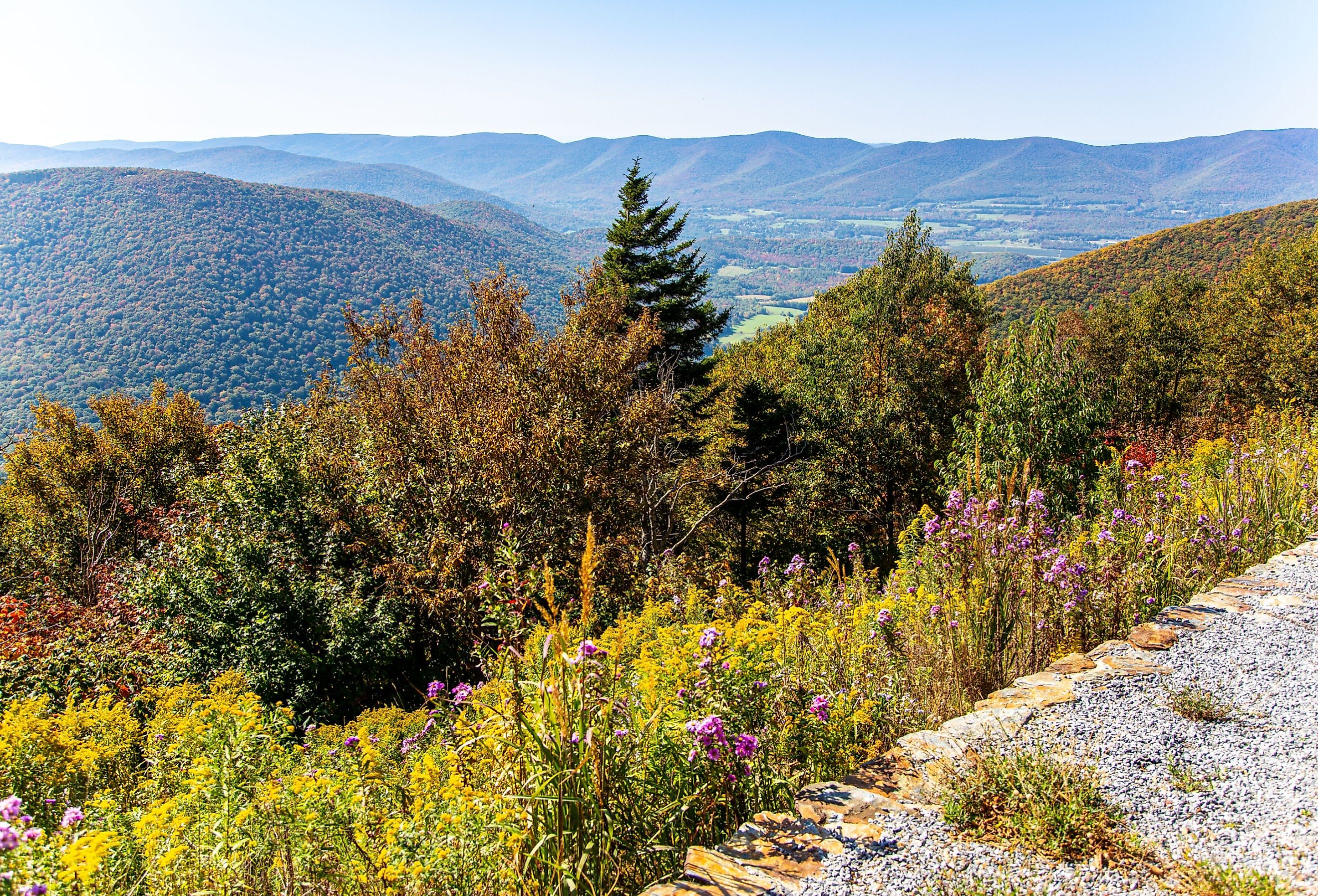
Virginia

Highest Point: Mount Rogers (5,729 feet)
The Appalachians grace all of Virginia's curving western section. The Blue Ridge Parkway, aka "America's Favorite Drive," is once again a major highlight (as it is split roughly equally between North Carolina and Virginia). According to the official mileposts, the 469-mile scenic drive flows in a northeast-southwest direction, starting in Shenandoah National Park, near Waynesboro, Virginia, and arriving in Great Smoky Mountains National Park, near Cherokee, NC. Virginia also boasts the longest section of the Appalachian Trail out of all 14 participating states (i.e., 531.7 miles, plus another 25.3 miles along the border with West Virginia).
West Virginia

Highest Point: Spruce Knob (4,863 feet)
Even though the Appalachian Mountains cover the majority of West Virginia's land area, the aptly nicknamed "Mountain State" sees the shortest section of the Appalachian Trail. With that said, the 2.4 in-state miles and 25.3 border miles are some of the best of the entire trek. Harpers Ferry National Historic Park is both picturesque and informative (it is a major Civil War site) and is also home to the welcoming town by the same name and the Appalachian Trail Conservancy Headquarters and Visitor Center. This place of respite has been dubbed the "psychological halfway point" by AT enthusiasts. West Virginia's other Appalachian highlights include Cooper Rock State Forest, New River Gorge National Park, Blackwater Falls State Park, and Cacapon Resort State Park (to name a few).
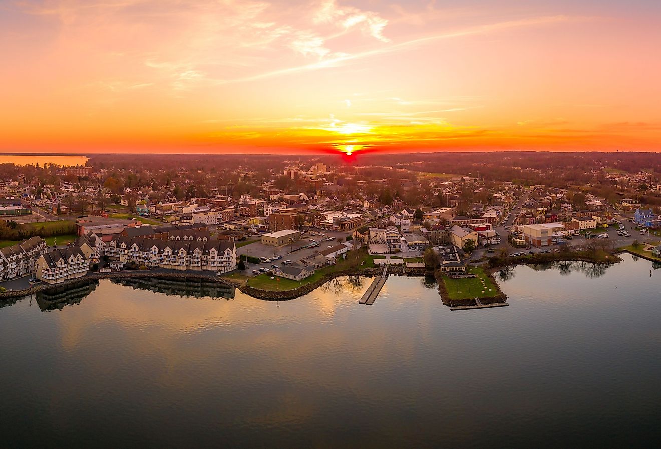
Maryland

Highest Point: Backbone Mountain (3,360 feet)
Squished between West Virginia and Pennsylvania, the long westward arm of Maryland is the part of this Mid-Atlantic state that wades into the Appalachian Mountains. This 40.9-mile section of the Appalachian Trail is considered one of the easier-going stretches. Here, the elevation ranges between 230 and 1,880 feet above sea level, and the trail rating is between one and six (i.e., easy to moderate). Maryland, therefore, is an excellent place for new hikers to foster an enthusiasm for the sport/pastime (depending on your approach). Maryland also benefits from easy access to the trail and is blessed with lots of nice overlooks, parks, and historic sites along the way. Besides the AT, the 49,000-acre Green Ridge State Forest (Maryland's largest contiguous public land area) is another great spot from which to enjoy the mountains and a slew of outdoor recreation.
Pennsylvania

Highest Point: Mount Davis (3,213 feet)
The Appalachians dominate the entire core of Pennsylvania. This part of The Keystone State is ideal for Civil War buffs (given that Pennsylvania saw significant movements by the armies of the North and South), fans of roadside artisan craft shopping (remember, we're knocking on Amish country now), and checking off oodles of state parks, including but certainly not limited to, Pine Grove State Park, where the Appalachian Trail Museum resides. As for the AT itself, this 230-mile segment ups the ante quite a bit after that Maryland respite. Dubbed "Rocksylvania," these trails can be rather technical at times, bringing hikers up and down rocky mountains between 320 and 2,080 feet in elevation.
New Jersey

Highest Point: High Point (1,803 feet)
Even though New Jersey is one of the most densely populated states, its little corner of Appalachia (at its northwesternmost extent) is surprisingly wholesome and spacious. With several major cities so close by, hustle-weary residents can retreat to the woods for a weekend reset. This stark contrast highlights the importance of preserving wild spaces, especially in the highly urbanized northeastern United States. Just over 72 miles of the Appalachian Trail roll through New Jersey, with Wallkill National Wildlife Reserve (which is replete with the state bird, the eastern goldfinch) being the banner attraction.
New York

Highest Point: Mount Marcy (5,344 feet)
New York typically connotes grid-locked Manhattan, but do not forget about Upstate New York (i.e., the vast majority of the state). Shortly after leaving the Big Apple, New York blossoms into an enriching landscape, thanks to the Finger Lakes, Great Lakes, Hudson Valley, and the bold green Appalachian Mountains. One important distinction to make when discussing New York's well-known ranges is that the Catskills are a subrange of the Appalachians. Still, the Adirondacks are a separate and much younger geological phenomenon. New York's 91-mile segment of the Appalachian Trail hangs close to Manhattan, meaning that from certain viewpoints in Harriman State Park, the distant Metropolitan skyline plays off of the proximate, unadulterated woodlands.
Connecticut

Highest Point: Bear Mountain (2,316 feet); Mount Frissell (2,380 feet)
We now enter the New England portion of the Appalachian range. Just as with New Jersey, the mountains run through just the northwestern corner of Connecticut. Nonetheless, hardwood forests, small lakes, cute waterfalls, verdant overlooks, and a few manageable peaks constitute quite a compelling landscape. The Connecticut portion of the Appalachian Trail climbs north for 52.2 miles, including a ¾-mile wheelchair access segment (the first of its kind on the AT), until reaching Bear Mountain at the Massachusetts state line. This represents the highest peak in Connecticut but not the highest point. The body of Mount Frisell, though it tops out in Massachusetts, surmounts Bear's summit by 64 feet.
Massachusetts

Highest Point: Mount Greylock (3,489 feet)
The Appalachian Trail continues its north-south trajectory through Massachusetts. The mountains themselves also head north into Vermont, as well as east into New Hampshire. The Bay State's take on Appalachia includes soothing river walks, a renewed selection of peaks that are covered in textured ridgelines, charming New England towns, and beloved natural areas, such as Mount Washington State Forest, October Mountain State Forest, and Mount Greylock State Reservation. Speaking of Mount Greylock, this is not only the highest point in Massachusetts, but local legend has it that this is where Herman Melville decided to write his acclaimed novel Moby Dick.
Vermont

Highest Point: Mount Mansfield (4,395 feet)
The vast majority of The Green Mountain State is covered by the Green Mountains (imagine that!) - a subrange of the Appalachians. Here, the Appalachian Trail stays the northbound course through the Green Mountain National Forest before veering east into New Hampshire (our penultimate stop on this journey through the Appalachian states) - amounting to 151 leg-testing miles between 400 and 4,000 feet. As you can imagine from the repeated references, Vermont's wilderness is as green as it comes. Dendrophiles will have no shortage of forest bathing opportunities in the 400,000-acre GMNF but don't forget about the Coolidge and Okemo State Forests to the southeast or Camel's Hump State Park to the north.
New Hampshire

Highest Point: Mount Washington (6,288 feet)
All but the southeast quadrant of New Hampshire resides within the Appalachians, though the White Mountain subrange is the object of adoration this time. As you may have noticed from the Highest Point references at the top of each entry, the peaks of New England have been steadily rising since entering Connecticut. In fact, the 161-mile portion of New Hampshire's Appalachian Trail features the most miles above the treeline out of any Appalachian state. Hikers can expect unimpeded views of the hardwood forests that blanket these stoic peaks and, when the weather is clear, the first hints of the Atlantic Ocean. Just note that because of the extended exposure, the weather is also notoriously brutal at times. Thankfully, the Mount Washington Cog Railway (i.e., the world's first mountain-climbing cog railway) chugs its way to the state's highest point, thereby taking out the guesswork and exertion for those just wanting to drink in the views.
Maine

Highest Point: Mount Katahdin (5,269 feet)
Maine marks the end of the American portion of the Appalachian Mountains and the northern terminus of the gargantuan Appalachian Trail. Though tantalizingly close to the finishing line, thru-hikers are put through the ringer one last time by The Pine Tree State. This 282-mile stretch is considered the most remote, rugged, and overall challenging and boasts the hardest mile of the entire trail: Mahoosuc Notch. With that said, Maine is one of a kind for New England nature lovers. Crystal-clear lakes, calming loon calls, and even sightings of the elusive (though locally abundant) moose can all be expected. Whether you're closing out the AT or simply looking for a compelling adventure in Maine's mountains, head to Baxter State Park and scale Mount Katahdin to share the magic with good company.
Final Thoughts
From northern Alabama (or maybe even northeastern Mississippi) all the way up to Canada's easternmost province, the Appalachian Mountains serve as the backbone of the east. This ancient range was settled at least 16,000 years ago by the indigenous nations of modern-day North America, and now, approximately 22 million people live amongst these verdant hills and valleys. Each Appalachian state shows off unique aspects of this ever-changing wilderness while maintaining an ineffable quintessence across invisible borders. What region calls out to you? (Queue the sonorous loon call).