Where is Walla Walla County, Washington?
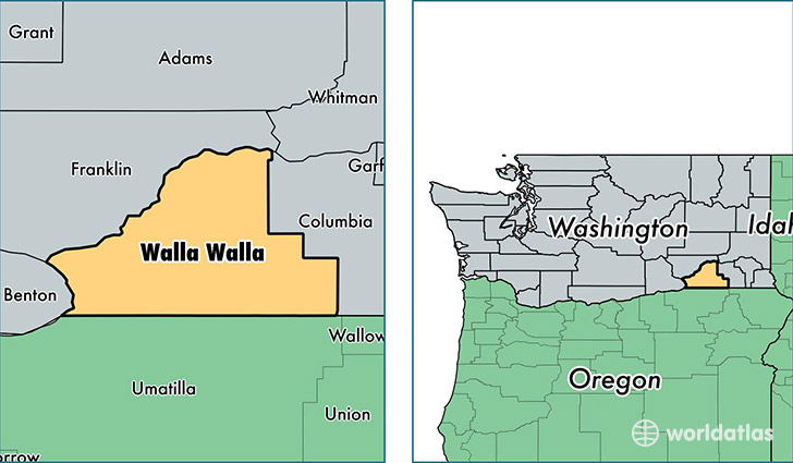
Walla Walla County is a county equivalent area found in Washington, USA. The county government of Walla Walla is found in the county seat of Walla Walla.
With a total 3,364.44 sq. km of land and water area, Walla Walla County, Washington is the 525th largest county equivalent area in the United States. Home to 59,844 people, Walla Walla County has a total 23629 households earning 46597 on average per year.
Walla Walla County, Washington offers the following attraction to visitors: Whitman Mission NHS
Walla Walla County, Washington - Quick Facts
| FIPS Code | 53071 |
| Area Codes | 509 |
| Time Zone | PST |
| Major Cities | Walla Walla (population: 41,491), College Place (population: 9,299), Burbank (population: 3,723), Waitsburg (population: 1,919), Prescott (population: 1,377), Touchet (population: 1,364), Wallula (population: 218), Dixie (population: 161) |
| Land Area | 23,106 sq miles |
| Water Area | 1,270 sq miles |
| Household Income | $46,597 |
| Housing Units | 23,629 |
| Median Home Value | $195,200 |
| High School Grads | 88% of population |
| Holders of Bachelors Degrees | 26% of population |
| Retail Spending | $9,286 per capita |
| Food & Accomodation Sales | $75,763 per capita |
| Universities and Colleges | Walla Walla Community College |
This page was last updated on June 30, 2016.