Where is Madison County, Montana?
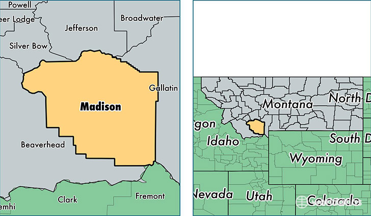
Madison County is a county equivalent area found in Montana, USA. The county government of Madison is found in the county seat of Virginia City.
With a total 9,330.84 sq. km of land and water area, Madison County, Montana is the 150th largest county equivalent area in the United States. Home to 7,820 people, Madison County has a total 6897 households earning 47762 on average per year.
Madison County, Montana - Quick Facts
| FIPS Code | 30057 |
| Area Codes | 406 |
| Time Zone | MST |
| Major Cities | Ennis (population: 2,152), Sheridan (population: 1,521), Twin Bridges (population: 969), McAllister (population: 497), Harrison (population: 332), Alder (population: 287), Virginia City (population: 211), Silver Star (population: 209), Cameron (population: 192), Pony (population: 159) |
| Land Area | 3,019 sq miles |
| Water Area | 3,587 sq miles |
| Household Income | $47,762 |
| Housing Units | 6,897 |
| Median Home Value | $239,600 |
| High School Grads | 95% of population |
| Holders of Bachelors Degrees | 33% of population |
| Retail Spending | $6,628 per capita |
| Food & Accomodation Sales | $14,998 per capita |
This page was last updated on June 30, 2016.