Where is New Madrid County, Missouri?
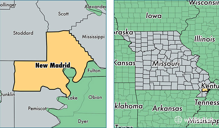
New Madrid County is a county equivalent area found in Missouri, USA. The county government of New Madrid is found in the county seat of New Madrid.
With a total 1,804.12 sq. km of land and water area, New Madrid County, Missouri is the 1449th largest county equivalent area in the United States. Home to 18,272 people, New Madrid County has a total 8498 households earning 35793 on average per year.
New Madrid County, Missouri - Quick Facts
| FIPS Code | 29143 |
| Area Codes | 573 |
| Time Zone | CST |
| Major Cities | Portageville (population: 4,832), New Madrid (population: 3,689), Lilbourn (population: 1,662), Gideon (population: 1,553), Matthews (population: 993), Morehouse (population: 817), Marston (population: 475), Risco (population: 341), Canalou (population: 336), Catron (population: 237) |
| Land Area | 7,055 sq miles |
| Water Area | 675 sq miles |
| Household Income | $35,793 |
| Housing Units | 8,498 |
| Median Home Value | $75,400 |
| High School Grads | 77% of population |
| Holders of Bachelors Degrees | 12% of population |
| Retail Spending | $28,850 per capita |
| Food & Accomodation Sales | $14,988 per capita |
This page was last updated on June 30, 2016.