Where is Owsley County, Kentucky?
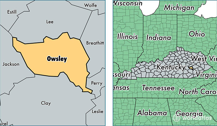
Owsley County is a county equivalent area found in Kentucky, USA. The county government of Owsley is found in the county seat of Booneville.
With a total 513.57 sq. km of land and water area, Owsley County, Kentucky is the 3026th largest county equivalent area in the United States. Home to 4,508 people, Owsley County has a total 2310 households earning 19986 on average per year.
Owsley County, Kentucky - Quick Facts
| FIPS Code | 21189 |
| Area Codes | 606 |
| Time Zone | EST |
| Major Cities | Booneville (population: 5,195), Ricetown (population: 240), Vincent (population: 53) |
| Land Area | 1,741 sq miles |
| Water Area | 197 sq miles |
| Household Income | $19,986 |
| Housing Units | 2,310 |
| Median Home Value | $56,200 |
| High School Grads | 61% of population |
| Holders of Bachelors Degrees | 12% of population |
| Retail Spending | $3,625 per capita |
This page was last updated on June 30, 2016.