Where is Henderson County, Kentucky?
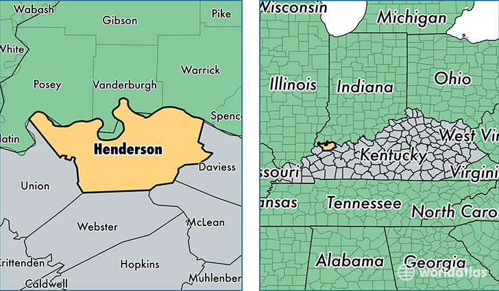
Henderson County is a county equivalent area found in Kentucky, USA. The county government of Henderson is found in the county seat of Henderson.
With a total 1,207.66 sq. km of land and water area, Henderson County, Kentucky is the 2299th largest county equivalent area in the United States. Home to 46,467 people, Henderson County has a total 20356 households earning 41940 on average per year.
Henderson County, Kentucky - Quick Facts
| FIPS Code | 21101 |
| Area Codes | 270 |
| Time Zone | CST |
| Major Cities | Henderson (population: 38,409), Corydon (population: 3,574), Robards (population: 2,152), Spottsville (population: 1,157), Reed (population: 787), Smith Mills (population: 228) |
| Land Area | 17,941 sq miles |
| Water Area | 437 sq miles |
| Household Income | $41,940 |
| Housing Units | 20,356 |
| Median Home Value | $99,400 |
| High School Grads | 85% of population |
| Holders of Bachelors Degrees | 16% of population |
| Retail Spending | $14,659 per capita |
| Food & Accomodation Sales | $54,742 per capita |
This page was last updated on June 30, 2016.