Where is Randolph County, Indiana?
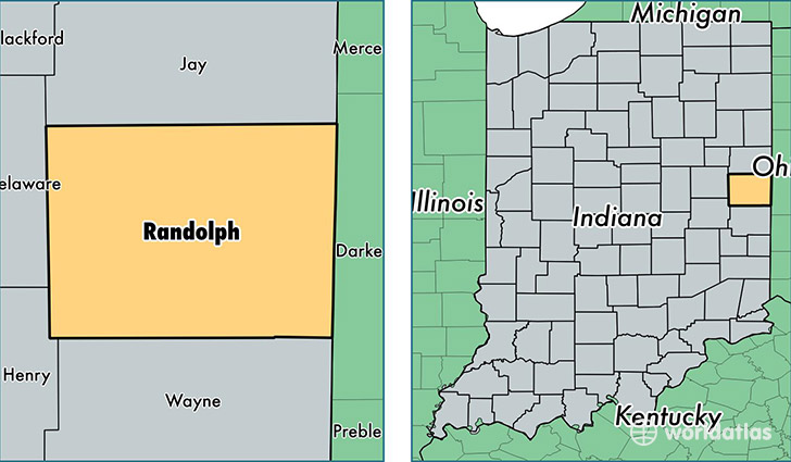
Randolph County is a county equivalent area found in Indiana, USA. The county government of Randolph is found in the county seat of Winchester.
With a total 1,174.08 sq. km of land and water area, Randolph County, Indiana is the 2331st largest county equivalent area in the United States. Home to 25,384 people, Randolph County has a total 11619 households earning 40904 on average per year.
Randolph County, Indiana - Quick Facts
| FIPS Code | 18135 |
| Area Codes | 765 |
| Time Zone | EST |
| Major Cities | Winchester (population: 8,354), Union City (population: 5,239), Farmland (population: 2,874), Lynn (population: 2,845), Parker City (population: 2,811), Ridgeville (population: 1,979), Losantville (population: 1,118), Modoc (population: 982), Saratoga (population: 197) |
| Land Area | 9,801 sq miles |
| Water Area | 453 sq miles |
| Household Income | $40,904 |
| Housing Units | 11,619 |
| Median Home Value | $76,200 |
| High School Grads | 85% of population |
| Holders of Bachelors Degrees | 12% of population |
| Retail Spending | $10,588 per capita |
This page was last updated on June 30, 2016.