Where is Jefferson County, Indiana?
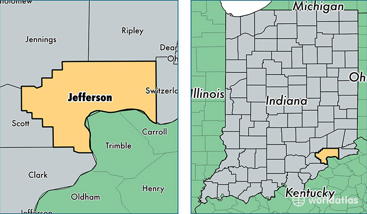
Jefferson County is a county equivalent area found in Indiana, USA. The county government of Jefferson is found in the county seat of Madison.
With a total 939.88 sq. km of land and water area, Jefferson County, Indiana is the 2700th largest county equivalent area in the United States. Home to 32,494 people, Jefferson County has a total 14275 households earning 43795 on average per year.
Jefferson County, Indiana - Quick Facts
| FIPS Code | 18077 |
| Area Codes | 812 |
| Time Zone | EST |
| Major Cities | Madison (population: 22,017), Hanover (population: 5,974), Lexington (population: 4,341), Deputy (population: 2,028), Dupont (population: 1,167), Canaan (population: 630) |
| Land Area | 12,546 sq miles |
| Water Area | 361 sq miles |
| Household Income | $43,795 |
| Housing Units | 14,275 |
| Median Home Value | $111,500 |
| High School Grads | 84% of population |
| Holders of Bachelors Degrees | 18% of population |
| Retail Spending | $11,801 per capita |
| Food & Accomodation Sales | $43,158 per capita |
| Universities and Colleges | Hanover College |
This page was last updated on June 30, 2016.