Where is Bartholomew County, Indiana?
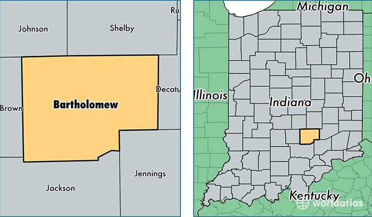
Bartholomew County is a county equivalent area found in Indiana, USA. The county government of Bartholomew is found in the county seat of Columbus.
With a total 1,060.66 sq. km of land and water area, Bartholomew County, Indiana is the 2549th largest county equivalent area in the United States. Home to 80,217 people, Bartholomew County has a total 33272 households earning 54165 on average per year.
Bartholomew County, Indiana - Quick Facts
| FIPS Code | 18005 |
| Area Codes | 812 |
| Time Zone | EST |
| Major Cities | Columbus (population: 69,469), Hope (population: 4,474), Elizabethtown (population: 2,881), Taylorsville (population: 837), Hartsville (population: 808), Clifford (population: 208), Jonesville (population: 160) |
| Land Area | 30,972 sq miles |
| Water Area | 407 sq miles |
| Household Income | $54,165 |
| Housing Units | 33,272 |
| Median Home Value | $134,900 |
| High School Grads | 89% of population |
| Holders of Bachelors Degrees | 27% of population |
| Retail Spending | $14,399 per capita |
| Food & Accomodation Sales | $139,684 per capita |
This page was last updated on June 30, 2016.