Where is Madison County, Iowa?
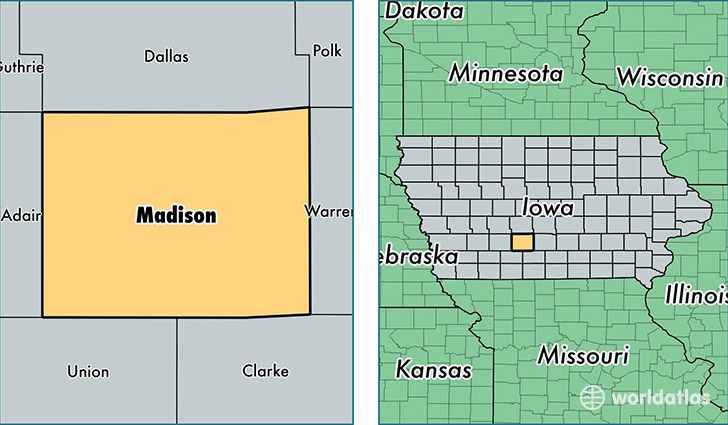
Madison County is a county equivalent area found in Iowa, USA. The county government of Madison is found in the county seat of Winterset.
With a total 1,455.98 sq. km of land and water area, Madison County, Iowa is the 1969th largest county equivalent area in the United States. Home to 15,609 people, Madison County has a total 6625 households earning 57581 on average per year.
Madison County, Iowa - Quick Facts
| FIPS Code | 19121 |
| Area Codes | 641,515 |
| Time Zone | CST |
| Major Cities | Winterset (population: 8,237), Earlham (population: 2,722), Saint Charles (population: 2,463), Truro (population: 991), Peru (population: 497), Macksburg (population: 254), Patterson (population: 138), Bevington (population: 43) |
| Land Area | 6,027 sq miles |
| Water Area | 561 sq miles |
| Household Income | $57,581 |
| Housing Units | 6,625 |
| Median Home Value | $160,700 |
| High School Grads | 94% of population |
| Holders of Bachelors Degrees | 22% of population |
| Retail Spending | $5,253 per capita |
| Food & Accomodation Sales | $7,596 per capita |
This page was last updated on June 30, 2016.