Where is Eagle County, Colorado?
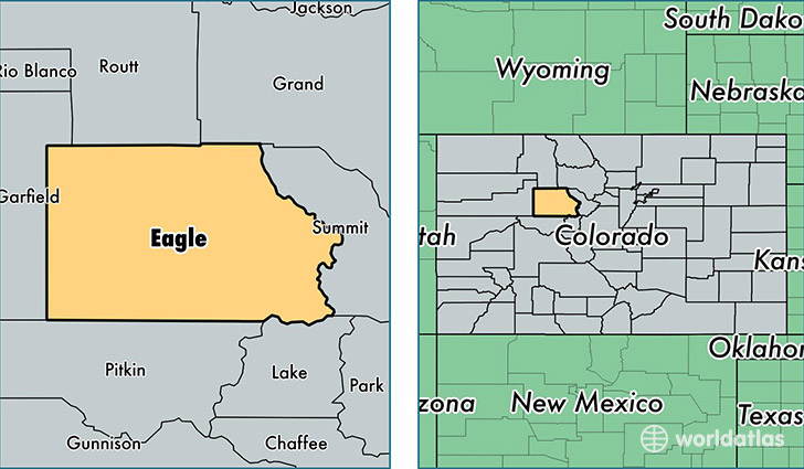
Eagle County is a county equivalent area found in Colorado, USA. The county government of Eagle is found in the county seat of Eagle.
With a total 4,381.72 sq. km of land and water area, Eagle County, Colorado is the 397th largest county equivalent area in the United States. Home to 52,921 people, Eagle County has a total 31367 households earning 74456 on average per year.
Eagle County, Colorado - Quick Facts
| FIPS Code | 8037 |
| Area Codes | 303,970 |
| Time Zone | MST |
| Major Cities | Avon (population: 10,385), Edwards (population: 10,212), Eagle (population: 8,164), Gypsum (population: 7,674), Basalt (population: 5,900), Vail (population: 5,546), Minturn (population: 1,114), Red Cliff (population: 275), Bond (population: 167), McCoy (population: 135) |
| Land Area | 20,433 sq miles |
| Water Area | 1,685 sq miles |
| Household Income | $74,456 |
| Housing Units | 31,367 |
| Median Home Value | $453,300 |
| High School Grads | 89% of population |
| Holders of Bachelors Degrees | 47% of population |
| Retail Spending | $18,367 per capita |
| Food & Accomodation Sales | $469,696 per capita |
This page was last updated on June 30, 2016.