Where is Gila County, Arizona?
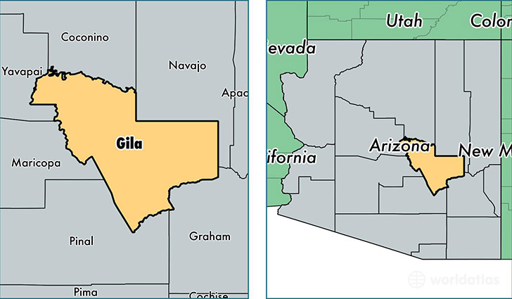
Gila County is a county equivalent area found in Arizona, USA. The county government of Gila is found in the county seat of Globe.
With a total 12,420.12 sq. km of land and water area, Gila County, Arizona is the 93rd largest county equivalent area in the United States. Home to 53,119 people, Gila County has a total 32947 households earning 39954 on average per year.
Gila County, Arizona offers the following attraction to visitors: Tonto NM
Gila County, Arizona - Quick Facts
| FIPS Code | 4007 |
| Area Codes | 928 |
| Time Zone | MST |
| Major Cities | Payson (population: 21,692), Globe (population: 13,232), San Carlos (population: 4,749), Miami (population: 4,490), Peridot (population: 3,205), Pine (population: 2,924), Tonto Basin (population: 1,488), Young (population: 771), Hayden (population: 624), Roosevelt (population: 578) |
| Land Area | 20,509 sq miles |
| Water Area | 4,758 sq miles |
| Household Income | $39,954 |
| Housing Units | 32,947 |
| Median Home Value | $134,000 |
| High School Grads | 84% of population |
| Holders of Bachelors Degrees | 16% of population |
| Retail Spending | $10,545 per capita |
| Food & Accomodation Sales | $106,693 per capita |
This page was last updated on June 30, 2016.