Where is Southeast Fairbanks Borough, Alaska?
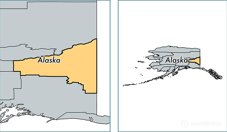
Southeast Fairbanks Borough is a county equivalent area found in Alaska, USA.
With a total 64,902.97 sq. km of land and water area, Southeast Fairbanks Borough, Alaska is the 9th largest county equivalent area in the United States. Home to 6,931 people, Southeast Fairbanks Borough has a total 3886 households earning 56801 on average per year.
Southeast Fairbanks Borough, Alaska offers the following attraction to visitors: Yukon Charley Rivers National Preserve
Southeast Fairbanks Borough, Alaska - Quick Facts
| FIPS Code | 2240 |
| Area Codes | 907 |
| Time Zone | PST-1 |
| Major Cities | Delta Junction (population: 5,092), Tok (population: 1,559), Northway (population: 294), Eagle (population: 190), Tanacross (population: 126), Chicken (population: 10) |
| Land Area | 2,676 sq miles |
| Water Area | 24,768 sq miles |
| Household Income | $56,801 |
| Housing Units | 3,886 |
| Median Home Value | $175,000 |
| High School Grads | 93% of population |
| Holders of Bachelors Degrees | 23% of population |
| Retail Spending | $6,906 per capita |
| Food & Accomodation Sales | $22,181 per capita |
This page was last updated on June 30, 2016.