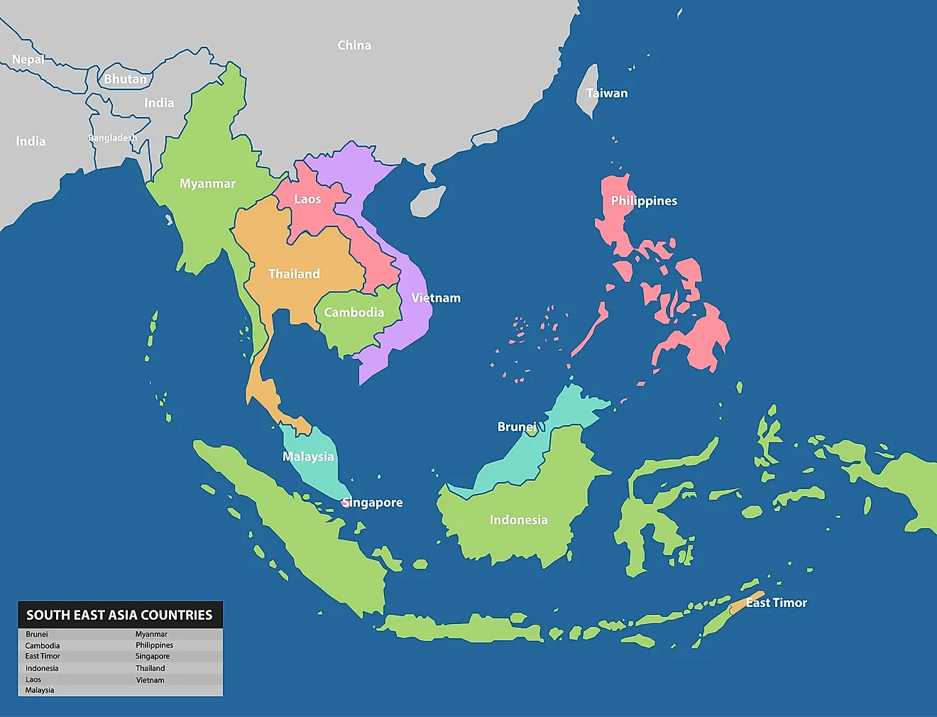
How Were The Islands In The Philippines Formed?
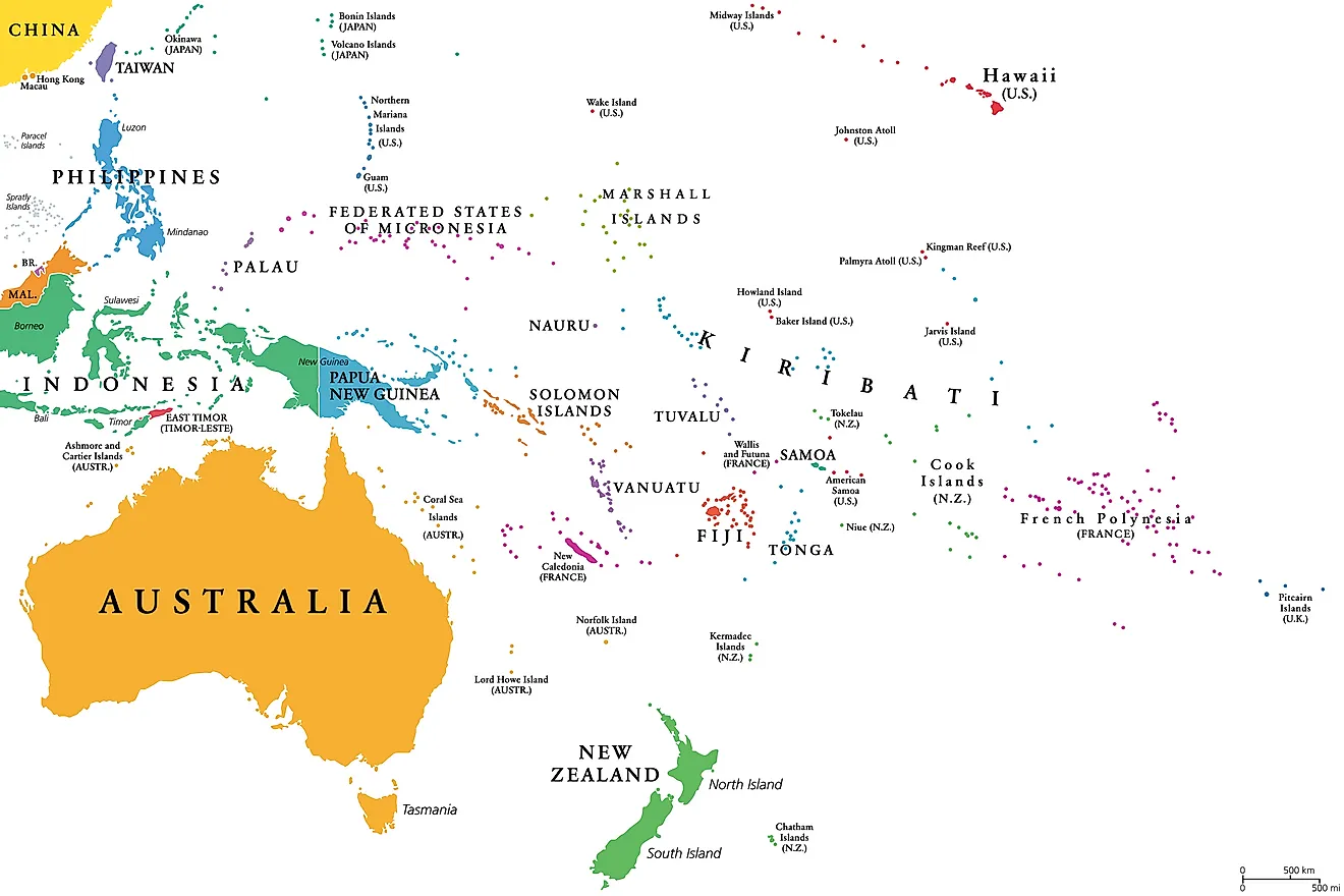
A few countries around the world are archipelagos, made up of thousands of islands. One such country is the Philippines which is made up of over 7,000 islands. The country is situated along the Pacific Rim of Fire, an active volcanic zone. The movement of tectonic plates and volcanic eruptions have contributed over millions of years to the formation of the islands of the Philippines.
Islands of the Philippines
The vast majority of the islands which make up the Philippines are of small size and 11 of the biggest islands account for over 90% of the country’s total land area. The two largest islands, Luzon and Mindanao, cover a combined area which is equivalent to over 50% of the country’s land area. Luzon alone occupies an area of 40,541 square miles while Mindanao covers an area of 36,680 square miles. The Philippines is situated about 500 miles from the Asian mainland and so has numerous unique geographical, geological, and historical characteristics.
Plate Tectonics
To understand how the islands were formed, it is important first to know about plate tectonics. Tectonic plates are the divisions of the earth’s crusts which are in constant movement. The movement of these plates is made possible by the churning of magma (molten rock) found beneath the crust. The plates are classified into two categories based on size; major plates and minor plates. The planet is made up of seven major plates and numerous other minor plates. At times one plate will collide with another, the result of which is that the heavier plate will move under the lighter one in what is known as subduction of plates. The process forces the underlying magma to the crust from where it emerges in violent eruptions. When the subduction and resultant eruptions happen in submerged sections of the crust over an extended period of geological time, it leads to the formation of island arcs.
The Foundation of the Archipelago
The presence of volcanic activity around the country offers a glimpse of the violent volcanic origin of the country which lies along the Pacific Ring of Fire. Some of the prominent volcanic features found in the country include the nation’s highest mountain, Mount Pinatubo, which is remembered for its violent eruption in 1991. The formation of the islands involved the movements of three plates which converged in the region, two of them being major plates (the Indo-Australian and Eurasian plates) and one minor plate (the Philippine Sea Plate). The Eurasian plate is made up of the continents of Asia and Europe and extends into the surrounding oceans and seas while the Indo-Australian plate is made up of the Indian subcontinent and the continent of Australia. The Philippine Sea Plate is the minor plate on which the islands of Taiwan, Indonesia, and the Philippines sit.
Formation of the Archipelago
Many of the thousands of islands which make up the Philippines are classified as island arcs which were formed as a result of subduction after the collision of the three plates (the Eurasian Plate, the Philippine Sea Plate, and the Indo-Australian Plate). The formation of the original island arcs is believed to have occurred millions of years ago at the southern part of the Philippine Sea Plate. The original island arcs are believed to have later collided with Sundaland forming a series of other islands in the archipelago.