Pacific Rim National Park Reserve
The Pacific Rim National Park is a three-part park located in the Canadian province of British Columbia. The park reserve covers approximately 511 km2 and is divided into three regions: the West Coast Trail, Broken Group Islands, and Long Beach. Set along the west coast of Vancouver Island, the park is one of Canada’s most cherished and popular natural treasures, known for long pristine beaches, lush green forests, and attractive coastal sceneries. The Pacific Rim National Park Reserve is Canada’s oldest national park reserve, established in 1970 after years of negotiations between the provincial and federal governments. It was included in the National Parks Act of Canada in 2000.
Geography

The Pacific Rim National Park Reserve stretches from Tofino in the north to Port Renfrew in the south. This natural treasure includes the Coast Mountains of the Pacific Coast Ranges, the Haida Gwaii Archipelago, and Vancouver Island. It is Vancouver Island’s only national park that protects both the marine environment and rainforest.
Long Beach

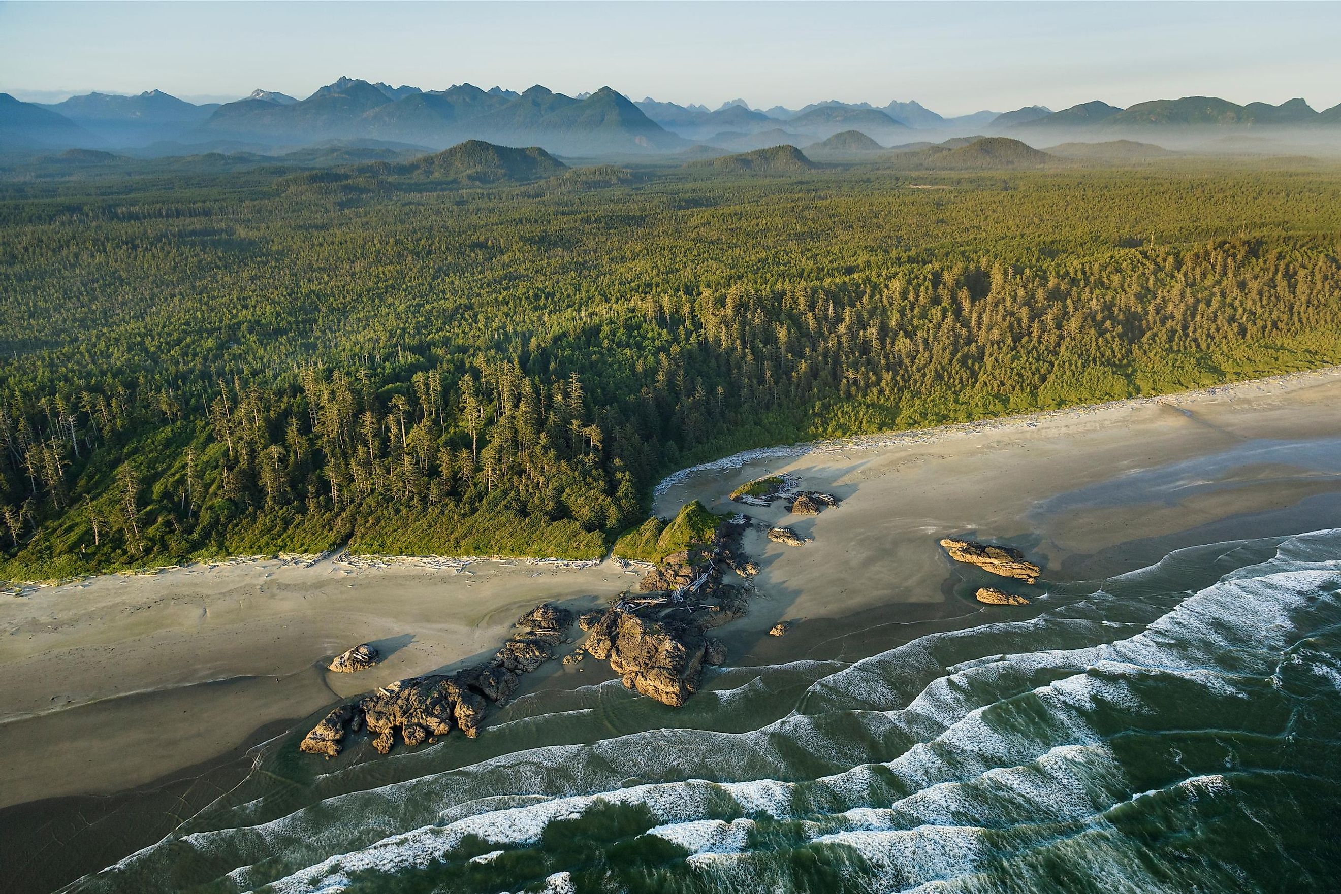
Long Beach is the largest and most visited region, spanning 212 km2 between Ucluelet and Tofino along Highway 4. This region features the sandy beaches of Wickaninnish and Schooner Cove, camping sites, and short trails. The Nuu-chah-nulth Trail, a 3 km trail, connects Wickaninnish Bay and Florencia Bay, with the Green Point Campground used as a camping area for campers. To Tofino’s south is Radar Hill, which provides an impressive view of the Gowlland Rocks, Meares Island, and Tofino Inlet. The Pacific Rim Visitor Center, located in the Long Beach Unit, is the park’s meeting point and information center.
Broken Group Islands

The BrokenIslands area stretches 106 km2 and comprises over 100 small islands, rock outcrops, and islets scattered in the Barkley Sound. Only about 14 km2 of the unit’s area is landmass, with most of the islands covered by forest. The unit’s largest forested islands are Turret, Effingham, Turtle, Jacques, Dodd, and Gibraltar Islands. The Broken Group Unit is popular for wilderness camping and kayaking. The unit has seven camping sites, located on Gibraltar, Gilbert, Clarke, Willis, Dodd, Turret, and Hand. Camping on Benson Island was abandoned in 2009 due to its cultural significance.
West Coast Trail

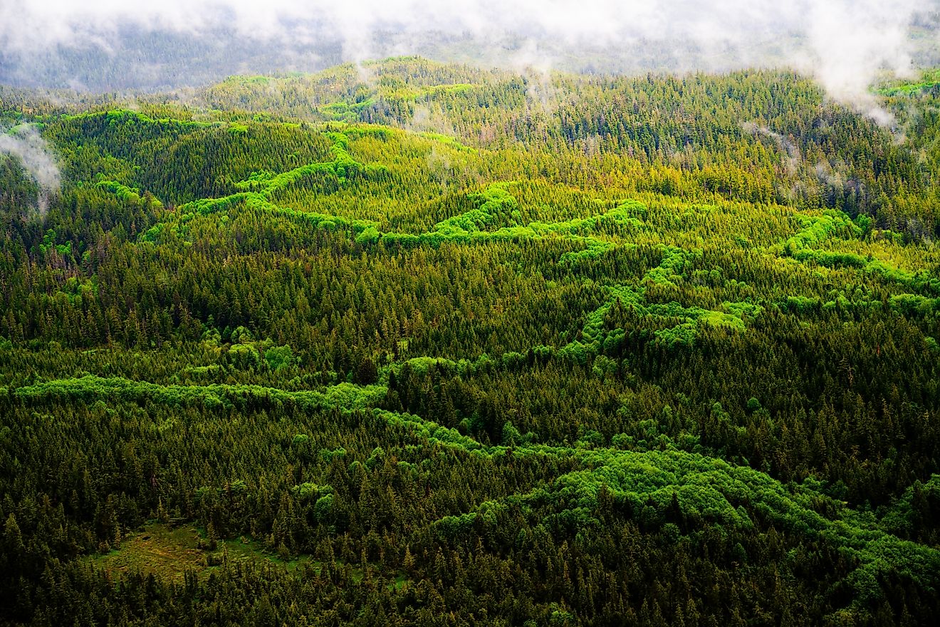
The West Coast Trail stretches 193 km2 on the Barkley Sound’s southeast coast between Bamfield and Port Renfrew villages. It contains the popular 75 km hiking trail for which this section of the park is named, constructed in 1907 to rescue shipwrecked mariners off Vancouver Island’s west coast. The hiking trail originated from a telegraph route created in the 1890s that connected Victoria with Bamfield. The region is dominated by temperate rainforests, featuring hemlock, spruce, and cedar. The forest is bordered by an ocean shoreline, to the west, where several paths lead towards the sandy beaches. West Coast Trail hosts some of Canada’s largest and tallest trees.
Indigenous Culture
Besides the natural landscape, the Indigenous Nuu-chah-nulth culture has dominated the park area for thousands of years. These whale hunters and mariners have depended on the park’s natural resources to trade and sustain their livelihood. They also resisted the Spanish and British who had access to the coast in the 18th century and used it as a source of timber, fur, and whale oil. Today, seven of the 15 original Nuu-chah-nulth tribes occupy the 21 reserves within the park. The tribes are actively involved in the park’s administration.