What are Landforms?
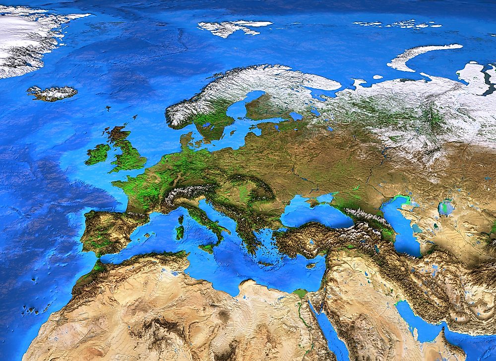
Landforms are natural planetary features that together make up a planet's terrain. Terrain, also known as "relief", is the third (vertical) dimension of the planet's surface. Continents and oceans are considered to be the most basic landforms, and the arrangement of smaller landforms within these bodies is known as topography, for continental features, and bathymetry, for undersea features. Landforms characterize the terrain of the earth, but can also be found on planetary bodies throughout the universe.
Working knowledge of landforms is important for a variety of scientific pursuits. Topographers study terrain, cartographers work to accurately represent relief on maps by methods such as contour lines or a Triangulated Irregular Network, and geomorphologists study the origin and evolution of the landforms themselves.
Landforms are categorized by their characteristic physical features, including location, height, pitch, stratification, and composition. Higher-order landforms such as mountains can be divided into ever smaller homogeneous divisions, on a scale ranging from a few hundred meters to hundreds of kilometers. Although they are naturally-occuring features, landforms can be influenced by a variety of factors including plate tectonics, erosion, and biological factors such as algae or vegetation.
What are Aeolian Landforms?
Aeolian landforms are planetary features that have been formed by wind, through either construction or erosion. The word "aeolian" is derived from Æolus, the Grecian god of wind. Found on Earth as well as other planets, aeolian features are created in areas where the wind erodes or deposits fine particles of sand, silt and clay. Particles are moved by one of four processes: creep (wind causes particles to roll or slide across a surface), lift (the Bernoulli effect causes particles to rise off of a surface), saltation (turbulent airflow facilitates transportation of larger particles), and impact transport (movement of one particle after being struck by a second moving particle). Characteristic aeolian landforms include dunes, sandhills, dry lakes, desert pavement, and ventifacts.
What are Cryogenic Landforms?
Cryogenic landforms are created by periglacial processes resulting from alternate freezing, thawing and cooling over time. Cryogenic weathering can affect soil and bedrock, while fluctuating temperatures can cause frost heaving, thermal contraction cracks, ice segregation, and solifluction. These events can form and shape a number of different landforms, including rock glaciers, thermokarst, nivation hollows, earth hummocks, cryoplanation terraces, and solifluction lobes or sheets.
What are Coastal/Oceanic Landforms?
These landforms include the oceans themselves, as well as relief features beneath the sea and along the surrounding coast. Coastal landforms can be broadly categorized into two types: erosional and depositional, resulting from the combination of various processes, sediments and geology. There are many types of coastal landforms including atolls, beaches, capes, cliffs, estuaries, fjords, arches, shoals, islands, reefs, caves, channels, dune systems and lagoons.
The world's five oceans combine to create a mega-landform that comprises 71% of the earth's surface. But beneath the surface, past the continental shelf, the ocean floor contains many other landforms, including some that are quite similar in scope to those found on the continents. These include mid-ocean mountain ranges, guyots, marine terraces, abysses, basins, plateaus, ridges, trenches and seamounts.
What are Erosion Landforms?
Erosion is a process by which sediment or other material is gradually taken away from a landform. This is facilitated by a number of factors, including wind, water, and other natural factors. Flowing water creates landforms such as canyons, ravines, gulches, gullies, valleys and natural terraces. Other erosion landforms occur through partial erosion, when softer materials eventually disappear and only the hardest rock is left behind. Landforms of this type include rock formations such as tors, arêtes, bornhardts, hogbacks, inselbergs, and inverted relief. Badlands occur in arid regions, with wind and water erosion forming landforms such as buttes, mesas and hoodoos. Other erosion landforms include dune seas, flatirons, and tropical lavakas.
What are Fluvial Landforms?
Fluvial landforms are created through processes associated with rivers and streams. Sediment is eroded, moved and deposited elsewhere in an ever-shifting cycle. In some areas, the riverbed is composed of loose sediment, and erosion can occur purely by the movement of clear water across the substrate. When the water is carrying a significant amount of sediment, the bed can also be eroded by abrasion, which in turn grinds down the moving sediment into smaller, rounder particles. Mobile sediment particles known as bedload are coarse, and move near the bottom of the river or stream, while finer particles are carried in a suspended load throughout water levels. The rate of sediment transportation depends on the speed of the water, as well as the materials present in the water and riverbed. Dropped particles, known as alluvium, eventually accumulate into larger alluvial deposits. Common fluvial landforms include sandbars, marshes rapids, bayous, floodplains, oxbow lakes, river deltas, wadis and fluvial islands or terraces.
What are Impact Landforms?
Impact events, or collisions between astronomical objects such as planets, moons, comets and asteroids, have occurred throughout the evolution of our solar system. The earth has survived many impact events, which can be observed in landforms such as craters and crater lakes. There is also evidence of impact landforms beneath the ocean, most notably the Chicxulub crater near the Yucatán peninsula, Mexico.
What are Karst Landforms?
Karst landforms are created through the dissolution of certain types of rocks, frequently limestone, dolomite and gypsum, but occasionally more resistant rocks such as quartzite. Karst landforms are typically porous, often including extensive underground drainage systems, sinkholes and caves. It is estimated that up to one half of the world's natural gas reserves can be found in Karst systems. These landforms occur throughout the world and include abîmes, calanques, cenotes, foibas, mogotes, turloughs, uvalas and limestone pavement.
What are Lacustrine Landforms?
Lacustrine landforms, also known as lake plains, began as lakes that became filled with sediment. Over time, water drains or evaporates from the lake, leaving the sediment deposits behind. Depending on the prevailing environment, the plan may become fertile farmland, a wetland, or a desert. Notable lacustrine landforms include playa lakes, oases, proglacial lakes, salt flats, and dry lakes.
What are Mountain/Glacial Landforms?
One of the most easily-observable landforms, mountains tower over the surrounding topography. The typical mountain landform consists of a large peak with a distinguishable summit. Other mountain landforms include ridges, hills, spurs, saddles, glacial horns and mountain passes.
Glacial landforms are created by glacial forces, including movement, cryogenics, abrasion, erosion and deposition. Landforms such as crevasses, dirt cones, moulins and glacial caves occur within the glaciers themselves. Other landforms, including kettle holes, moraines, drumlins, kames, cirques, nunataks, outwash fans and hanging valleys show the effects of glacial forces on the surrounding land.
What are Slope Landforms?
Slope landforms are formed by tectonic activity and erosion. These landforms can range in scope from gentle rises to nearly vertical cliff faces. Common slope landforms include flats and plains, as well as bluffs, cliffs, escarpments, scree, terraces, knolls, mesas, and plateaus.
What are Tectonic Landforms?
Most of the earth's landforms are tectonic in origin, and are later shaped by erosion and other forces. Tectonic landforms are created primarily by processes contributing to the rising and falling of the earth's crust. This can occur at the boundary between tectonic plates or elsewhere on the surface of the earth. Tectonic forces affect topography by causing elevation or depression. Elevated landforms include mountain ranges, horsts, domes, fault scarps, and mid-ocean ridges, while depressed landforms include asymmetric and rift valleys, graben, and oceanic basins and trenches.
What are Volcanic Landforms?
These landforms include volcanoes, volcanic features and other landforms that have been produced by volcanic activity in a given area. Volcanoes range in size and scope from the traditional conical strato-volcano to the low-lying shield volcano or cinder cone to volcanic islands which, if measured from the sea floor, would represent the highest mountains on Earth. A caldera is formed by an extremely violent eruption, after which the lava chamber collapses inward. This crater can fill up with water, forming a volcanic crater lake, or occasionally a new somma volcano will form in the depression. Other volcano types include cryptodomes, diatremes, tuff cones, subglacial mounds, tuyas, and extinct volcanoes such as guyots and seamounts. Landforms that are volcanic in origin but are not true volcanoes include magmatic dikes, fissure vents, geysers, hornitos, mud pots, coulees, lava spines and tubes, maars, mid-ocean ridges, pit craters, and volcanic plugs.
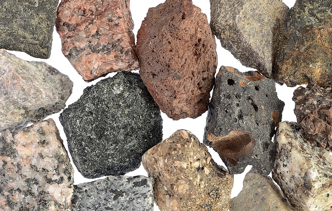
What are Weathering Landforms?
Many of the earth's landforms are influenced by weathering processes. While the affect of weathering is similar to that of erosion -- materials break down through contact with water, wind, air and living organisms -- weathering occurs at the source and involves little transportation of material. Mechanical weathering, also known as physical weathering, occurs when rock or soil breaks down through processes involving direct contact with temperature, pressure, water and other atmospheric conditions. Chemical weathering, also known as biological weathering, is a breakdown of rock, soil or mineral substances caused by atmospheric or biological chemicals. Primary material, such as feldspar or mica, is slowly converted into secondary minerals such as clays and carbonates, which in turn release soluble nutrients that combine with other organic material to form soil. Common landforms that have been influenced or formed by weathering include bornhardts and inselbergs, etchplains, flared slopes, flutes, nubbins, karst sinkholes, tafonis, honeycomb weathering, panholes and tors.