Maps of Venezuela

Covering a total area of 916,445 sq.km (353,841 sq mi), Venezuela, located on the northern coast of South America is the world's 33rd largest country. As observed on the physical map of Venezuela, the Orinoco River and Venezuela's mountain ranges divide the country into some distinct topographical regions, all with different climates.
The Maracaibo Lowlands of the far northwest are dry, windless and hot; the Andes Mountains and northern highlands are more temperate and much cooler in the higher elevations; the central plain fronting the Orinoco River covers about one-third of the country, most of it is less than 50 meters in elevation, and generally quite warm. The wild and largely unexplored Guiana Highlands covering the southeast, with elevations of up to 3,500 meters, are jungle-tropical, hot and very humid.
The country’s highest point – Pico Bolivar at 4,979 m (16,335ft) [as marked on the map as an upright yellow triangle] lies in the northern mountains.
The world’s highest waterfall – the Andes Mountains Angel Falls is located in the Guiana Highlands; standing at 2,421 feet, (751 m) or more than 12 times the height of America’s and Canada’s Niagara Falls. With over 10,000 rivers (mostly small) within Venezuela’s borders, the Orinoco is by far the most important. It's the third-longest river in South America, after the Parana and the Amazon; it has more than 2,000 tributaries - including the Apure, Arauca, Caron, Caura, Guaviare, Meta and Ventuari. Most of the other rivers that rise in the northern mountains flow south-eastward to the Apure. Significant lakes include Lake Guri and Lake Maracaibo – the largest lake in South America.
States of Venezuela Map

Venezuela (officially, the Bolivarian Republic of Venezuela) is divided into 23 states (estados, singular - estado), 1 Capital district (Distrito Capital), and Federal Dependencies (Dependencias Federales). In alphabetical order, the States are: Amazonas, Anzoategui, Apure, Aragua, Barinas, Bolivar, Carabobo, Cojedes, Delta Amacuro,Falcon, Guarico, Lara, Merida, Miranda, Monagas, Nueva Esparta, Portuguesa, Sucre, Tachira, Trujillo, Vargas, Yaracuy and Zulia. The country is further subdivided into a total of 335 municipalities and over 1000 parishes.The Federal Dependencies comprises of Venezuela's many offshore islands and islets in the Caribbean Sea.
Covering a total area of 916,445 sq.km, Venezuela is the world's 33rd largest country. Located along the Guaire River in the country's northern part is, Caracas - the capital, the largest and the most populous city of Venezuela. It is also the country's cultural capital as well as the administrative, educational, industrial and commercial center of Venezuela.
Where is Venezuela?

Venezuela is located on the northern edge of South America. It is geographically positioned in the Northern and Western hemispheres of the Earth. Venezuela is bordered by Brazil to the south; by Guyana to the east; by Colombia to the west and southwest. It is also bounded by the North Atlantic Ocean to the northeast and by the Caribbean Sea to the north. Venezuela shares maritime borders with Barbados, The Dominican Republic, Dominica, Saint Kitts & Nevis, Saint Lucia, Trinidad and Tobago and Puerto Rico.
Venezuela Bordering Countries: Guyana, Brazil, Colombia.
Regional Maps: Map of South America
Outline Map of Venezuela

The above blank map represents Venezuela - a country located on the northern coast of South America. The above map can be downloaded, printed and used for geography education purposes like map-pointing and coloring activities.

The above outline map represents Venezuela - a country located on the northern coast of South America. The nation is roughly triangular in shape and has incredible biodiversity.
Key Facts
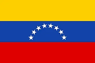
| Legal Name | Bolivarian Republic of Venezuela |
|---|---|
| Flag |
|
| Capital City | Caracas |
| 10 29 N, 66 52 W | |
| Total Area | 912,050.00 km2 |
| Land Area | 882,050.00 km2 |
| Water Area | 30,000.00 km2 |
| Population | 28,515,829 |
| Major Cities |
|
| Currency | Bolivars (VEB) |
| GDP | $482.36 Billion |
| GDP Per Capita | $16,054.49 |
This page was last updated on February 25, 2021