Maps of Suriname

Covering an area of 163,820 sq.km (63,252 sq mi), Suriname is one of the smallest sovereign nations, located on the northern edge of South America. Suriname can be divided into two main geographic regions; the coastal lowlands of the north and the tropical rainforests and savanna of the west and south.
As observed on the physical map of Suriname above, a few small mountain ranges disect the fertile land with the De Hann and Van Asch Van Wijck being the most significant ones. The country's highest point is Julianatop, at an elevation of 4,035ft (1,230m). The lowest point is an unnamed location along the coastal plain at -6.5ft (-2m) below the sea level.
Suriname is home to the WJ van Bloomenstein Lake (marked on the map above in the eastern part of the country), one of the largest reservoir lakes on the planet; created by a river dam, it provides hydro power for many of the country's industries.
About 14% of Suriname is allocated to a series of National Parks (NP) and Nature Reserves (NR). Suriname is a land of rivers, and the major ones include the Coppename, Corantyne, Gran, Lucie, Marowijne, Nickerie and Saramacca.
Districts of Suriname Map

Suriname (officially, the Republic of Suriname) is divided into 10 administrative districts (distrikten, singular - distrikt).In alphabetical order, these districts are:Brokopondo, Commewijne, Coronie, Marowijne, Nickerie, Para, Paramaribo, Saramacca, Sipaliwini and Wanica. These districts are further subdivided into 63 resorts.
Covering an area of 163,820 sq. km, Suriname is one of the smallest sovereign nations in South America. Situated in the northern part of the country, on the banks of the Suriname River, at the Atlantic coast is, Paramaribo - the capital, the largest and the most populous city of Suriname. It is also the country's chief port and the administrative, industrial, cultural and tourism center of Suriname.
Where is Suriname?

Suriname is a small country located on the northern edge of South America. It is geographically positioned both in the Northern and Western hemispheres of the Earth. It is bordered by Brazil to the south; by French Guiana to the east; by Guyana to the west and by the North Atlantic Ocean to the north.
Suriname Bordering Countries: Guyana, Brazil.
Regional Maps: Map of South America
Outline Map of Suriname

The above blank map represents Suriname, a small country located in the northern coast of South America. The above map can be downloaded, printed and used for geography educational purposes like map-pointing and coloring activities.

The above outline map represents Suriname - a small country located in the northern coast of South America. It is one of the America's most ethnically diverse nations.
Key Facts
| Legal Name | Republic of Suriname |
|---|---|
| Flag |
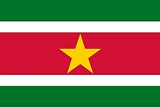
|
| Capital City | Paramaribo |
| 5 50 N, 55 10 W | |
| Total Area | 163,820.00 km2 |
| Land Area | 156,000.00 km2 |
| Water Area | 7,820.00 km2 |
| Population | 581,372 |
| Currency | Surinamese dollars (SRD) |
| GDP | $3.99 Billion |
| GDP Per Capita | $6,854.91 |
This page was last updated on February 25, 2021