Maps of Papua New Guinea

Covering an area of 462,840 sq.km (178,700 sq mi), Papua New Guinea is the 3rd largest island nation and the world’s 54th largest country.
The nation of Papua New Guinea contains the eastern half of the island of New Guinea, as well as the islands of New Ireland, New Britain, and Bougainville, in addition to numerous smaller islands.
As observed on the physical map of Papua New Guinea above, much of the island nation is mountainous and covered in tropical rainforests. The New Guinea Highlands - a chain of mountains and river valleys, runs the length of the New Guinea island.
As marked on the map by an upright yellow triangle, the highest point of Papua New Guinea is Mount Wilhelm – at an elevation of 14,793 ft (4,509 m). The lowest point of Papua New Guinea is the Pacific Ocean (0m).
Rivers of note include the Sepik River which winds its way through lowland swamp plains to the northern coast, and the Fly River which flows through one of the largest swamplands in the world on its way to the south coast of the island.
Due to its location along the Pacific Ring of Fire, Papua New Guinea has several volcanoes and is prone to earthquakes and tsunamis. It's most active volcano, Rabaul Caldera, is situated on the island of New Britain, and as of March 2013 is engaged in an eruptive phase that began in January 2013.
Provinces of Papua New Guinea Map

Papua New Guinea (officially, the Independent State of Papua New Guinea) is divided into 20 provinces, Bougainville autonomous region and National Capital District. In alphabetical order, these provinces are: Central, Chimbu, Eastern Highlands, East New Britain, East Sepik, Enga, Gulf, Hela, Jiwaka, Madang, Manus, Milne Bay, Morobe, New Ireland, Northern, Southern Highlands, Western, Western Highlands, West New Britain and West Sepik. Each of these provinces are further divided into one or more districts. These districts are further subdivided into one or more local-level government areas (LLG).
Covering an area of 462,840 sq.km, Papua New Guinea is the world’s 3rd largest island nation and the world’s 54th largest country. Located on the southeastern coast of the island country, along the shores of the Gulf of Papua is, Port Moresby – the capital and the largest city of Papua New Guinea. It is also the largest city in the South Pacific region which is located outside Australia and New Zealand.
Where is Papua New Guinea?

Papua New Guinea is an island nation in Oceania located in southwestern Pacific Ocean. It occupies the eastern half of New Guinea (the world’s 2nd largest island) and includes numerous offshore islands. Papua New Guinea is geographically positioned both in the Southern and Eastern hemispheres of the Earth. Its neighbors are: Indonesia to the west; Australia to the south and Solomon Islands to the south-east. It is bounded by the Pacific Ocean, Bismarck Sea, Solomon Sea, Coral Sea, Torres Strait and Gulf of Papua.
Papua New Guinea Bordering Countries: Indonesia.
Regional Maps: Map of Oceania
Outline Map of Papua New Guinea

The above blank map represents Papua New Guinea - an island nation in Oceania located in southwestern Pacific Ocean. The above map can be downloaded, printed and used for geography education purposes like map-pointing and coloring activities.

The above outline map represents Papua New Guinea - an island nation in Oceania located in southwestern Pacific Ocean. It is one of the world’s most culturally diverse nations.
Key Facts
| Legal Name | Independent State of Papua New Guinea |
|---|---|
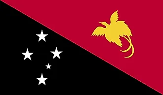
| Flag |
|
| Capital City | Port Moresby |
| 9 27 S, 147 11 E | |
| Total Area | 462,840.00 km2 |
| Land Area | 452,860.00 km2 |
| Water Area | 9,980.00 km2 |
| Population | 8,776,109 |
| Largest City |
Port Moresby (409,831) |
| Currency | Kina (PGK) |
| GDP | $24.97 Billion |
| GDP Per Capita | $2,845.18 |
This page was last updated on February 25, 2021