Maps of Nauru

Covering an area of only 21 sq.km (8.1 sq mi), Nauru is an island nation and a microstate in Oceania, located in southwestern Pacific Ocean. Nauru is a raised, fossilized coral atoll and is one of the three great phosphate rock islands in the Pacific Ocean. The island is dominated by a central phosphate plateau which is surrounded by coral cliffs. A century of phosphate mining has stripped four-fifths of the total land area and has left behind a barren terrain.
Coral reefs surround the island and are exposed at low tide being dotted with pinnacles. The island is ringed by windswept palm trees and a sandy beach. Inward from the beach lies a wide fertile coastal strip of 150-300m. The highest point of the plateau is Command Ridge at an elevation of 233ft (71m). Due to presence of reefs, there are no harbors or protected anchorages.
There are no rivers and lakes on the Island; only a landlocked, freshwater lake – Buada Lagoon is found in the Buada district of the Island. The lowest point is the South Pacific Ocean (0m).
Districts of Nauru Map

Nauru (officially, the Republic of Nauru) is divided into 14 administrative districts. These districts are: Aiwo, Anabar, Anetan, Anibare, Baitsi, Boe, Buada, Denigomodu, Ewa, Ijuw, Meneng, Nibok, Uaboe and Yaren. These districts are further divided into villages.
Covering an area of only 21 sq.km, the Micronesian island nation of Nauru is the world’s smallest republic and a microstate in Oceania, located in southwestern Pacific Ocean. The island nation has the world’s 3rd smallest land area and has no official capital city. Located on the southern coast of the island country is, the district of Yaren – the de facto capital of Nauru. It houses the legislature and a number of government offices. Situated in the western part of the island nation is, Denigomodu – the largest and the most populous district of Nauru.
Where is Nauru?

Nauru is an island nation and a microstate in Oceania, located in southwestern Pacific Ocean. It is geographically positioned to the south of the Equator and hence lies both in the Southern and Eastern hemispheres of the Earth. Nauru is situated to the northeast of Sydney (Australia) and the Solomon Islands, to the east of Banaba Island (Kiribati), to the northwest of Tuvalu, to the east-northeast of Papua New Guinea; to the southeast of the Federated States of Micronesia and to the south of the Marshall Islands.
Regional Maps: Map of
Outline Map of Nauru

The above blank map represents Nauru - an island nation and a microstate in Oceania, located in southwestern Pacific Ocean. The above map can be downloaded, printed and used for geography eduaction purposes like map-pointing and coloring activities.

The above outline map represents Nauru - an island nation and a microstate in Oceania, located in southwestern Pacific Ocean. It is a small oval-shaped coral island.
Key Facts
| Legal Name | Republic of Nauru |
|---|---|
| Flag |
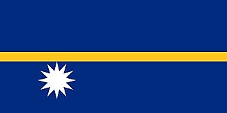
|
| Capital City | no official capital; government offices in the Yaren District |
| Total Area | 21.00 km2 |
| Land Area | 21.00 km2 |
| Water Area | N/A |
| Population | 12,581 |
| Currency | Australian dollars (AUD) |
| GDP | $118.22 Million |
| GDP Per Capita | $9,396.98 |
This page was last updated on November 23, 2020