Maps of Saint Kitts and Nevis

Saint Kitts and Nevis is a twin island country covering an area of 261 sq. km (101 sq mi). It is located in the eastern Caribbean Sea. The dual island nation of Saint Kitts and Nevis is the smallest sovereign nation in the Western hemisphere. Both islands are actually the summits of a submerged volcanic mountain range.
As observed on the physical map of Saint Kitts and Nevis above, Nevis is cone shaped, with a central volcanic peak; Nevis Peak. The island has a narrow coastal plain that rises gently into the upper elevations. There are a scattering of white and black sand beaches. St. Kitts is an elongated oval in shape, except for a long, narrow peninsula to the southeast. It’s narrow coastal plain rises steeply into the upper elevations. It is comprised of a group of volcanic peaks, the highest of which is Mount Liamuiga, formerly Mount Misery, a dormant volcano, some 1,156m (3,792 ft) high.
Parishes of Saint Kitts and Nevis Map

Saint Kitts and Nevis (officially, the Federation of Saint Christopher and Nevis) is divided into 14 parishes. The 9 parishes that are in Saint Kitts are: Christ Church Nichola Town, Saint Anne Sandy Point, Saint George, Saint John Capisterre, Saint Mary Cayon, Saint Paul Capisterre, Saint Peter Basseterre, Saint Thomas Middle Island and Trinity Palmetto Point. The 5 parishes that are in Nevis are: Saint George Gingerland, Saint James Windward, Saint John Figtree, Saint Paul Charlestown and Saint Thomas Lowland.
Covering a total combined area of 261 sq. km, the dual island nation of Saint Kitts and Nevis, is the smallest sovereign nation in the Western hemisphere. Located on the south western coast of the larger island of Saint Kitts is, Basseterre – the capital and the largest city of Saint Kitts and Nevis. It is a major port and an administrative center of the country and the industrial and economic center of St. Kitts.
Where is Saint Kitts and Nevis?

Saint Kitts and Nevis is a twin island country located in the eastern Caribbean Sea. They are also a part of the Leeward Islands chain in the Lesser Antilles; and are geographically positioned in the Northern and Western hemispheres of the Earth. Nevis is a small island located southeast of Saint Kitts and is separated by a narrow channel – The Narrow Strait. They are surrounded by the Caribbean Sea and the Atlantic Ocean. Saint Kitts and Nevis shares maritime borders with Sint Eustatius, Saba, Saint Barthelemy, Saint Martin, Anguilla, Antigua, Barbuda, Redonda, Venezuela and Montserrat.
Regional Maps: Map of North America
Outline Map of Saint Kitts and Nevis

The above blank map represents Saint Kitts and Nevis – a twin island country located in eastern Caribbean Sea. The above map can be downloaded, printed and used for educational purposes.

The above outline map represents Saint Kitts and Nevis – a twin island country located in eastern Caribbean Sea. Nevis is a cone-shaped island while Saint Kitts is an elongated oval shaped island.
Key Facts
| Legal Name | Federation of Saint Kitts and Nevis |
|---|---|
| Flag |
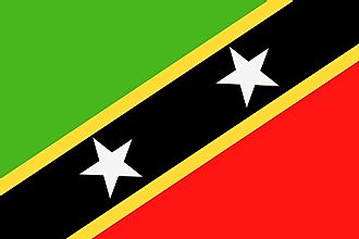
|
| Capital City | Basseterre |
| 17 18 N, 62 43 W | |
| Total Area | 261.00 km2 |
| Land Area | 261.00 km2 |
| Water Area | N/A |
| Population | 52,823 |
| Currency | East Caribbean dollars (XCD) |
| GDP | $1.05 Billion |
| GDP Per Capita | $19,896.50 |
This page was last updated on February 25, 2021