Maps of Grenada

Covering a total area of only 348.5 sq. km (134.6 sq mi), the country of Grenada consists of the main island of Grenada, the larger islands of Carriacou and Petit Martinique, and some 600 small islets, mostly uninhabited. The islands of the country of Grenada are all volcanic in origin and vary in elevation from 300m (984ft), to over 600m (1,968 ft).
As observed on the map, the island of Grenada itself is more mountainous than the others and are covered by dense forest. Its land rises from a narrow, coastal plain into areas of dormant volcanic ridges and valleys. Mount St. Catherine is the highest point rising to 840 m (2,760 ft). The island is drained by many small rivers flowing to the sea, all cutting deeply into the slopes.
A few of the mountains contain crater basins, and one includes a large crater lake named Grand Etang. The lake is over 1700ft above sea level, and is surrounded with some of the island's most beautiful rainforest. Waterfalls are scattered across the upper-reaches of Grenada, as well as a few boiling springs; the River Sallee boiling springs is the most significant.
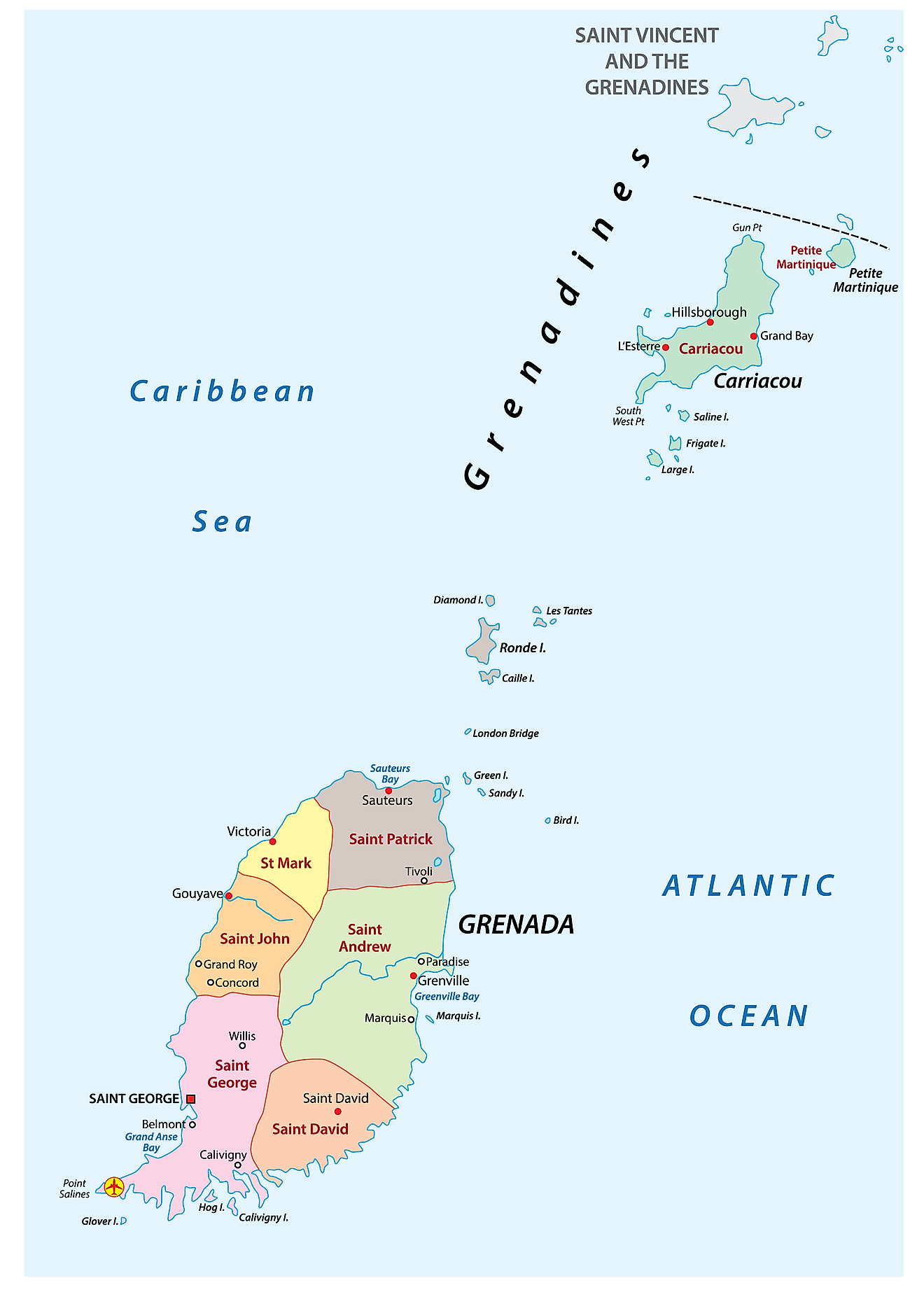
Grenada is divided into 6 parishes and 1 dependency. In alphabetical order, the parishes are: Saint Andrew, Saint David, Saint George, Saint John, Saint Mark and Saint Patrick. Carriacou and Petite Martinique have the status of a dependency.
Covering a total area of only 344 sq. km, Grenada is one of the smallest independent nations in the Western hemisphere; and is famously known as the ‘Island of Spice’. Located on a horseshoe-shaped harbour is St. George’s – the capital and the largest city of Grenada. It is the administrative center of the country and is a popular tourist destination in the Caribbean.
Where is Grenada?

Grenada is an island nation located between the Caribbean Sea and the Atlantic Ocean, occupying the southernmost part of the Grenadines chain of islands. It is positioned both in the Northern and Western hemispheres of the Earth. Grenada is situated to the northeast of Venezuela; to the northwest of Trinidad and Tobago; and to the southwest of Saint Vincent and Grenadines.
Regional Maps: Map of North America
Outline Map of Grenada

The above blank map represents Grenada, an island nation located in the Caribbean Sea. The above map can be downloaded, printed and used for educational purposes like map-pointing activities and coloring etc.

The above outline map represents Grenada, an island nation in the Caribbean Sea. The islands are of volcanic origin and are oval in shape, having a highly mountainous terrain.
Key Facts
| Legal Name | Grenada |
|---|---|
| Flag |
|
| Capital City | Saint George's |
| 12 03 N, 61 45 W | |
| Total Area | 344.00 km2 |
| Land Area | 344.00 km2 |
| Water Area | N/A |
| Population | 112,003 |
| Currency | East Caribbean dollars (XCD) |
| GDP | $1.23 Billion |
| GDP Per Capita | $10,965.51 |
This page was last updated on November 20, 2023