Maps of Slovenia

Slovenia occipies an area of 20,271 sq. km in Central Europe. As observed on the physical map above, Slovenia has a highly elevated terrain with over 40% of the country being mountainous. The country can be roughly divided into four physigraphic regions.
The Alps extend across the northern and northwestern parts of the country. The High Alps comprising of the Kamnik, Savinja, Karavanke, and Julian Alps run along Slovenia's border with Austria and Italy. The Julian Alps hosts the country's highest point (marked by the yellow triangle). It is the Triglav Peak at an elevation of 9,396 ft (2,864 m) above sea-level. Located within the Julian Alps are two glacial lakes (Bohinj and Bled), and major rivers include the Drava and Sava. South of the High Alps is the subalpine region with the Pohorje as one of the major ranges in the region.
To the southwest of Slovenia is the Kras or Karst region which is a spur of the Dinaric Alps. Here, there are several caves and underground rivers.
To the east and northeast is the fertile Subpannonia region which includes the river valleys of the Drava, Sava, and Mura rivers. Many important cities are located here. The courses of these rivers through Slovenia can be seen on the map above.
Occupying only a small part of the country is the Slovene Littoral region to the southwest which includes the 29-mile (47-km) coastline along the Adriatic Sea.
Slovenia is also heavily forests. is ranked third in Europe for being the most forested country, with over half of its land covered with forests.
Regions of Slovenia Map

Slovenia (officially, the Republic of Slovenia) is divided into 12 regions, 201 municipalities (obcine, sing. obcina) and 11 urban municipalities (mestne obcine, sing. mestna obcina).
In alphabetical order, the regions are: Carinthia, Central Sava, Central Slovenia, Coastal-Karst, Drava, Gorizia, Littoral-Inner Carniola, Lower Sava, Mura, Savinja, Southeast Slovenia and Upper Carniola.
In alphabetical order, the municipalities are: Ajdovscina, Ankaran, Apace, Beltinci, Benedikt, Bistrica ob Sotli, Bled, Bloke, Bohinj, Borovnica, Bovec, Braslovce, Brda, Brezice, Brezovica, Cankova, Cerklje na Gorenjskem, Cerknica, Cerkno, Cerkvenjak, Cirkulane, Crensovci, Crna na Koroskem, Crnomelj, Destrnik, Divaca, Dobje, Dobrepolje, Dobrna, Dobrova-Polhov Gradec, Dobrovnik/Dobronak, Dolenjske Toplice, Dol pri Ljubljani, Domzale, Dornava, Dravograd, Duplek, Gorenja Vas-Poljane, Gorisnica, Gorje, Gornja Radgona, Gornji Grad, Gornji Petrovci, Grad, Grosuplje, Hajdina, Hoce-Slivnica, Hodos, Horjul, Hrastnik, Hrpelje-Kozina, Idrija, Ig, Ilirska Bistrica, Ivancna Gorica, Izola/Isola, Jesenice, Jezersko, Jursinci, Kamnik, Kanal, Kidricevo, Kobarid, Kobilje, Kocevje, Komen, Komenda, Kosanjevica na Krki, Kostel, Kozje, Kranjska Gora, Krizevci, Krsko, Kungota, Kuzma, Lasko, Lenart, Lendava/Lendva, Litija, Ljubno, Ljutomer, Log-Dragomer, Logatec, Loska Dolina, Loski Potok, Lovrenc na Pohorju, Luce, Lukovica, Majsperk, Makole, Markovci, Medvode, Menges, Metlika, Mezica, Miklavz na Dravskem Polju, Miren-Kostanjevica, Mirna, Mirna Pec, Mislinja, Mokronog-Trebelno, Moravce, Moravske Toplice, Mozirje, Muta, Naklo, Nazarje, Odranci, Oplotnica, Ormoz, Osilnica, Pesnica, Piran/Pirano, Pivka, Podcetrtek, Podlehnik, Podvelka, Poljcane, Polzela, Postojna, Prebold, Preddvor, Prevalje, Puconci, Race-Fram, Radece, Radenci, Radlje ob Dravi, Radovljica, Ravne na Koroskem, Razkrizje, Recica ob Savinji, Rence-Vogrsko, Ribnica, Ribnica na Pohorju, Rogaska Slatina, Rogasovci, Rogatec, Ruse, Selnica ob Dravi, Semic, Sevnica, Sezana, Slovenska Bistrica, Slovenske Konjice, Sodrazica, Solcava, Sredisce ob Dravi, Starse, Straza, Sveta Ana, Sveta Trojica v Slovenskih Goricah, Sveti Andraz v Slovenskih Goricah, Sveti Jurij ob Scavnici, Sveti Jurij v Slovenskih Goricah, Sveti Tomaz, Salovci, Sempeter-Vrtojba, Sencur, Sentilj, Sentjernej, Sentjur, Sentrupert, Skocjan, Skofja Loka, Skofljica, Smarje pri Jelsah, Smarjeske Toplice, Smartno ob Paki, Smartno pri Litiji, Sostanj, Store, Tabor, Tisina, Tolmin, Trbovlje, Trebnje, Trnovska Vas, Trzic, Trzin, Turnisce, Velika Polana, Velike Lasce, Verzej, Videm, Vipava, Vitanje, Vodice, Vojnik, Vransko, Vrhnika, Vuzenica, Zagorje ob Savi, Zalec, Zavrc, Zelezniki, Zetale, Ziri, Zirovnica, Zrece, and Zuzemberk. The urban municipalities are: Celje, Koper-Capodistria, Kranj, Ljubljana, Maribor, Murska Sobota, Nova Gorica, Novo Mesto, Ptuj, Slovenj Gradec and Velenje.
Located in the central part of the country, surrounded by the Julian Alps is, Ljubljana – the capital and the largest city of Slovenia. It is also the cultural, administrative and economic center of Slovenia.
Where is Slovenia?

Slovenia is located in Central and South Eastern Europe. Slovenia is positioned both in the Northern and Eastern hemispheres of the Earth. It is bordered by 4 countries: by Austria in the north; Hungary in the northeast; Italy in the west; and Croatia in the southeast. Slovenia also shares a small coastline along the Adriatic Sea in the South west.
Slovenia Bordering Countries: Italy, Hungary, Austria, Croatia.
Regional Maps: Map of Europe
Outline Map of Slovenia

The above blank outline map represents the southeastern European country of Slovenia. The map can be downloaded, printed, and used for map-pointing tests or coloring.

The map represents Slovenia, a country in Southeastern Europe.
Key Facts
| Legal Name | Republic of Slovenia |
|---|---|
| Flag |
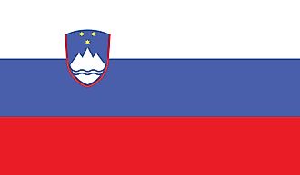
|
| Capital City | Ljubljana |
| 46 03 N, 14 31 E | |
| Total Area | 20,273.00 km2 |
| Land Area | 20,151.00 km2 |
| Water Area | 122.00 km2 |
| Population | 2,087,946 |
| Currency | Euros (EUR) |
| GDP | $53.74 Billion |
| GDP Per Capita | $25,739.25 |
This page was last updated on February 25, 2021