Maps of Montenegro

The southeast European country of Montenegro occupies an area of 13,812 sq. km.
As observed on the physical map of Montenegro, the country is highly mountainous. Ranging from towering peaks along the Serbian and Albanian borders to a small coastal plain, it is home to a diverse landscape due to its position on the Balkan peninsula and the Adriatic Sea.
Consisting of some of the most rugged terrain in Europe, Montenegro's most notable mountain ranges include the Durmitor range, Mount Orjen and Mount Lovcen.
The highest point is Bobotov Kuk, located in the Durmitor range, with an elevation of 8,274 ft (2,522 m). It has been marked on the map by a yellow triangle.
East, along the Adriatic Sea, a prominent element on the Montenegrin coast is a submerged river canyon known as the Bay of Kotor. It is about 28 km (17 mi) long. The Lovćen and Orjen mountains surround the bay to the east and west respectively.
Significant rivers of Montenegro include the Drina, Tara and Lim. As observed on the map above, Lake Skadar is located on the Montenegro-Albania border. It is Montenegro's largest lake and is shared with Albania. It is also Southern Europe's biggest lake and has a surface area of 370–530 km2 (140–200 sq mi). The average depth of Lake Skadar is 5.01 m (16.4 ft).
The lowest point in Montenegro is the Adriatic Sea at 0 m.
Municipalities of Montenegro Map

Montenegro is divided into 24 municipalities (opstine, sing. opstina). In alphabetical order, the municipalities are: Andrijevica, Bar, Berane, Bijelo Polje, Budva, Cetinje (Old Royal Capital), Danilovgrad, Gusinje, Herceg-Novi, Kolasin, Kotor, Mojkovac, Niksic, Petnjica, Plav, Pljevlja, Pluzine, Podgorica Capital City, Rozaje, Savnik, Tivat, Tuzi, Ulcinj and Zabljak. The Podgorica capital city is further divided into 1 subdivision called Golubovci City municipality.
Located in central Montenegro, Podgorica is the Capital and the largest city of Montenegro. It serves as the cultural, administrative and economic center of the country. The city of Cetinje (designated as Prijestonica) is the former Royal Capital of Montenegro.
Where is Montenegro?

Montenegro is a small mountainous country located in South Eastern Europe on the Balkan Peninsula. It is positioned in the Northern and Eastern hemispheres of the Earth. Montenegro has a coast on the Adriatic Sea to the south. It is bordered by 5 countries: by Croatia in the southwest; Bosnia and Herzegovina in the northwest; Serbia in the northeast; Kosovo in the east and Albania in the southeast.
Montenegro Bordering Countries: Albania, Serbia, Croatia, Bosnia And Herzegovina.
Regional Maps: Map of Europe
Outline Map of Montenegro


Key Facts
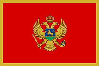
| Legal Name | Montenegro |
|---|---|
| Flag |
|
| Capital City | Podgorica; note - Cetinje retains the status of "Old Royal Capital" |
| 42 26 N, 19 16 E | |
| Total Area | 13,812.00 km2 |
| Land Area | 13,452.00 km2 |
| Water Area | 360.00 km2 |
| Population | 622,137 |
| Currency | Euros (EUR) |
| GDP | $5.49 Billion |
| GDP Per Capita | $8,832.04 |
This page was last updated on February 25, 2021