Maps of Monaco

As the second-smallest independent state in the world, after the Vatican City, Monaco is a very hilly, rugged and rocky country. The country covers an area of only 2.1 sq. km.
Monaco sits on the Mediterranean Coast, and is almost entirely urban. The highest point is Mont Agel, which rises to 459 ft (140 m). The lowest point is the Mediterranean Sea coast at sea level.
Quarters of Monaco Map

Monaco (officially, the Principality of Monaco) is divided into 4 quarters (quartiers, sing quartier). They 4 quarters are: Monaco-Ville (Rock of Monaco), La Condamine, Monte Carlo and Fontvieille. The quartier of La Condamine is further subdivided into: La Condamine proper, Moneghetti, Les Revoires and La Colle. The Monte Carlo quartier is also subdivided into several neighbourhoods: Monte Carlo proper, Larvotto, Saint Roman Tenao, Saint Michel.
[Note: As per CIA World Factbook, there are no first-order administrative divisions as defined by the US Government. Moneghetti, a part of La Condamine is sometimes called the 5th quarter of Monaco].
With an area of just 2.1 sq. km, and a population of 38,682 residents, with 19,000 inhabitants /sq. km, Monaco is one of the most densely populated sovereign states in the world. Monaco is one of the smallest sovereign States in Europe. After Vatican City, it is the 2nd smallest sovereign State in the world. [The Principality of Monaco is a single administrative unit, and hence no separate area within its territory has been distinguished as its capital.]
Where is Monaco?

Monaco is a small sovereign city state located on the French Riviera in Western Europe. It is positioned both in the Northern and Eastern hemispheres of the earth. Monaco is bordered by France in the north, west and east. It is bounded by the Mediterranean Sea to the south.
Regional Maps: Map of Europe
Outline Map of Monaco

The above map represents Monaco, the world's most densely populated nation and also one of the smallest ones. The map can be downloaded, printed, and used for map-pointing work or coloring.

The above map is of Monaco, one of the world's smallest countries. It is a microstate surrounded on three sides by France and bordered by the Mediterranean Sea to the south.
Key Facts
| Legal Name | Principality of Monaco |
|---|---|
| Flag |
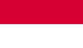
|
| Capital City | Monaco |
| 43 44 N, 7 25 E | |
| Total Area | 2.00 km2 |
| Land Area | 2.00 km2 |
| Water Area | N/A |
| Population | 38,964 |
| Currency | Euros (EUR) |
| GDP | $7.19 Billion |
| GDP Per Capita | $185,829.02 |
This page was last updated on February 24, 2021