Corsica
There are hundreds of islands in the Mediterranean Sea, but the landmasses are shared between only nine countries. Most of the islands belong to Greece and Croatia, while Italy and Spain also have a sizable number. France, meanwhile, has a small handful, with the most notable French island being Corsica, the sea’s fourth-largest island. It is also one of 18 French regions, with Ajaccio as its capital. Although Corsica has two administrative departments, it is a single territory collectivity and is more autonomous than the other French regional collectivities.
Contents
Where Is Corsica?

Corsica is an expansive island in the Mediterranean Sea. It lies off mainland France's southeastern coast. It is bounded to the northwest by Monaco, north and west by Italy, and south by Sardinia Island. The Strait of Bonifacio separates Corsica and Sardinia. It is also separated from the Italian Peninsula by the Ligurian Sea in the north and the Tyrrhenian Sea in the east. The island is approximately 170 km from mainland France in the west and 90 km from northwestern Italy.
Geography

Corsica is the Mediterranean Sea’s fourth-largest island after Cyprus, Sardinia, and Sicily. The island is approximately 183 km long from north to south and about 83 km wide from west to east. Its coastline is about 1,000 km, and it covers an estimated 8,722 km2 or under 2% of France's total land area.
Corsica formed about 250 million years ago following the uplift of a granite backbone in the island’s western portion. 200 million years later, sedimentary rocks pressed against the granite, leading to the formation of schist on the island’s eastern side. The island is often referred to as the “mountain in the sea” because of its mountainous nature.
Most parts of Corsica’s terrain are mountainous. Close to two-thirds of its area consists of mountains, while forests cover 20%. The mountain chain runs from northwest to southeast. 120 of the island's peaks are at least 2,000 m (6,600 feet) tall, with Mount Cinto as the highest point at 2,706 m (8,878 feet). These mountains display vivid colors due to the granite rocks and dramatic mountain silhouettes. To the east of the mountain chain are cliffs and large alluvial plains.
Corsica is drained by several seasonal rivers rising from the mountains. Golo, Liamone, Tavignano, Tarova, and Granove are some of the island’s main rivers.
Climate
Corsica’s coastal areas experience a hot-summer Mediterranean climate, with daily mean temperatures about 10 °C (51 °F) in winter and 24 °C (75 °F) during the summer. The inland areas experience temperatures relatively lower than the coastal areas due to the elevation. Some of the areas on higher elevation experience a subarctic climate or cold-summer Mediterranean climate. Ajaccio, the island’s capital, records an annual average high temperature of 20 °C (68 °F) and receives average annual precipitation of 645 mm.
Brief History

The origin of the name “Corsica” is unclear, although there are several debates about the subject. Ancient Greeks referred to the island as Corsis or Cirné among other names. The name Cirné was derived from the oldest Greek name for the island, Seirinoussai, meaning “of the sirens.” The sirens referred to in this ancient name are likely the same in Homer's Odyssey.
Corsica was first occupied during the Mesolithic era. Carthaginians, Ancient Greeks, and Etruscans later occupied the island before it fell to the Roman Republic, after their success in the First Punic War. The island, alongside Sardinia, became a Roman province in 238 BCE. Although the Romans built colonies on Corsica, particularly Aléria, they considered the island a backward region.
Corsica has switched hands multiple times over the course of its history, often violently. When the Roman Empire’s western half collapsed in the 5th century, the Ostrogoths and Vandals invaded the island. It soon became March of Tuscany’s dependency, who used it as an outpost against its enemies, particularly the Saracens. Corsica was later ruled by Pisa and Genoa and was a source of contention for these two territories. After the 16th century conflict for rule over the island got France and Spain involved, Corsica fell conclusively into Genoa's hands. In the 18th century, Corsicans began a revolution against Genoa for independence, which succeeded in minimizing Genoese control over certain parts of the island. In 1767, Genoa decided to sell off the island to France because they felt they could not sustain future fights against their enemies. In 1768, the Treaty of Versailles was signed, effectively ending Genoese rule. French troops invaded Corsica and enforced French rule on the previously semi-independent island.
Human Settlement

Prior to 1975, Corsica was a department of Provence-Alpes-Cote d’Azure. In 1975, the department of Corsica was split into two departments: Corse-du-Sud and Haute-Corse. Seven years later, the island was granted a territorial collectivity status. Consequently, the Corsican Regional Council was abolished, while the Corsican Assembly, with executive powers, was established in 1992, alongside an Executive Body and an advisory body known as Economic, Cultural, and Social Council.
Corsica is home to about 339,200 people. Native Corsicans account for about 56% of the island’s population, with natives of mainland France being 28%. The island has a significant portion of immigrants, of which 34% are from Morocco, 22% are from Portugal, and 13% from Italy. Ajaccio, the island’s capital located on the west coast, is the largest settlement, with about 71,000 inhabitants. Haute-Corse is the larger of the two administrative departments, with over 177,000 inhabitants.
Economy

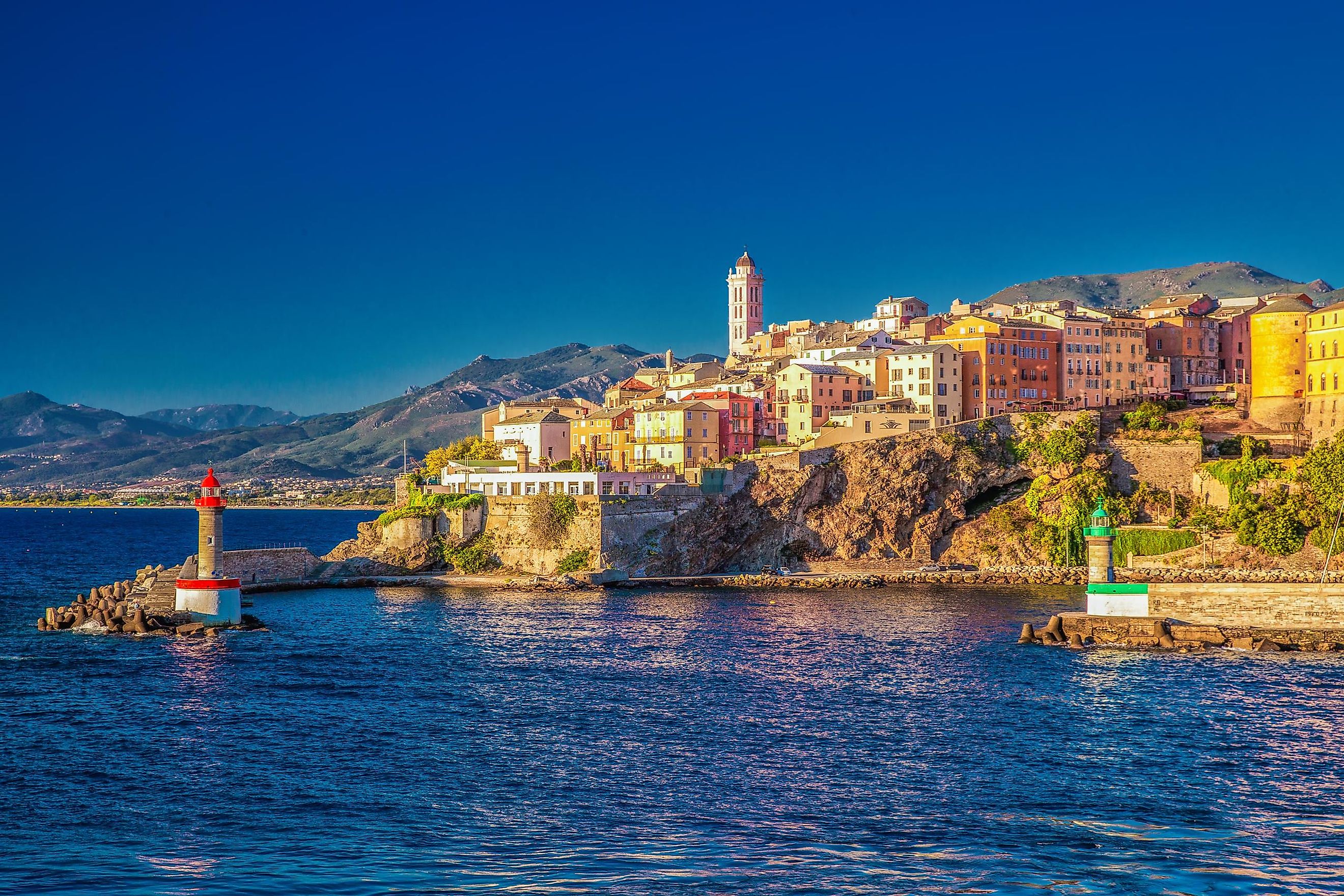
In 2018, the island region had a GDP of £9.6 billion, an equivalent of 0.4% of the entire country’s economic output. The per capita GDP adjusted for purchasing power was £25,400. Tourism is the main economic driver due to the island’s coastline, climate, and mountains. The natural landscape is still largely intact since there has not been intensive development on the island. Bonifacio, a region near the strait separating Corsica and Sardinia, as well as Porto Vecchio and Calvi are the most visited places on the island.
There are four major airports on the island, served by Air Corsica and Air France. The airports are the island’s main connection to other cities in Europe. Corsica is also served by a network of railways, with the mainline running between Ajaccio and Bastia. Besides airports, the island is also connected to France and Italy by ferry lines. Bastia is the busiest seaport, serving over 2.5 million passengers in 2012. Other major seaports are Ajaccio and Calvi.
Wildlife

Corsica is covered by shrubs, woodlands, and Mediterranean forests. The island is covered with luxuriant vegetation, including shrubs and flowers, which have earned it the name “Scented Isle.” About 40% of the land area is designated as nature reserves. Cork oaks and holm oaks dominate the coastal lowland areas. However, much of the lowland vegetation has been affected by human activities, such as logging, grazing, and agriculture. Diverse forests characterize higher elevations (600-1,800 m). This temperate montane zone is characterized by broadleaf deciduous trees, pines, and oaks.
The forests and coastal lowlands host several animals, including hooded crows and bearded vultures. The Parc Naturel Régionale de Corse, established in 1972, protects rare plants and animals. It includes the Scandola Nature Reserve, a UNESCO World Heritage Site. Corsican red deer and mouflon are found in the park. The Corsican nuthatch, Corsican brook salamander, and Corsican fire salamander are some of the island’s endemic species.


