Maps of Yemen

Yemen is a sovereign nation with an area of 527,970 sq. km. Mainland Yemen lies in the Arabian Peninsula of Asia. The country has an extensive coastline of around 2,000 km and over 200 islands. As observed on the physical map of Yemen above, the Socotra Islands are also a part of the country.
Yemen has some of the most fertile lands in the entire Middle East, and yet, for the most part, they're not developed to their full potential. Along its Red Sea coast, there's a flat sandy plain that extends the length of the country. The Gulf of Aden coastline is covered by a narrow, rocky, and relatively flat plain, fronted by hills that rise into the rugged mountains, central and west.
To the north of those central mountains, the high desert slopes down through fertile plains into the interior of southern Saudi Arabia, and the endless sands of the Rub' Al Khali Desert - the famous "Empty Quarter."
Marked on the map by a yellow upright triangle, Yemen's highest point is Jabal an Nabi Shu'ayb at 3,760 m.
There are no perennial lakes and rivers, however, in the northern highlands, some river valleys (wadis) and small streams exist (fall and winter) but fade away quickly in the summer heat.
Governorates and Districts of Yemen Map

Yemen (officially the Republic of Yemen) is divided into two main administrative divisions. They are known as Governorates (Arabic: muhafazat, singular – muhafazah) and Districts (Arabic: muderiah). Governorates constitute the highest administrative division in Yemen. There are 22 governorates including the capital city - Amanat al Άsmiah (Sanaa City) and Arkhabil Suqutra (Socotra Archipelago).
In alphabetical order, the 22 governorates are – Άdan (Aden), Άmran, Abyan, Ad Dali´, Al Bayda, Al Hudaydah, Al Jawf, Al Mahrah, Al Mahwit, Amanat al Άsmiah (Sanaa City), Arkhabil Suqutra (Socotra Archipelago), Dhamar, Hadramawt, Hajjah, Ibb, Lahij, Ma´rib, Raymah, Sa´dah, San´a (Sanaa), Shabwah, and Ta´izz.
The 22 governorates are further subdivided into 333 districts and smaller subdivisions including 2,210 sub-districts and 38,284 villages.
Sana´a is the largest city in Yemen and the capital of the country.
Where is Yemen?

Yemen is an arid country situated in the Middle-East region at the south-western corner of the Arabian Peninsula in Western Asia. It is located in the Northern and Eastern Hemispheres of the Earth. Yemen is bordered by two countries. Saudi Arabia bounds it to the north and Oman to the east. Yemen has a coastline on the Red Sea to the west. The Gulf of Aden, the Arabian Sea, and Guardafui Channel bound it to the south. Yemen is strategically located at the entrance of the Bab-el-Mandeb Strait. The strait links the Indian Ocean to the Red Sea via the Gulf of Aden.
Yemen Bordering Countries: Saudi Arabia, Oman.
Regional Maps: Map of Asia
Outline Map of Yemen

The outline map above represents mainland Yemen. The map may be downloaded, printed, and used for coloring or education purpose.

The outline map represents the mainland area of the country of Yemen in the Middle East region of Asia.
Key Facts
| Legal Name | Republic of Yemen |
|---|---|
| Flag |
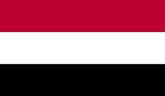
|
| Capital City | Sanaa |
| 15 21 N, 44 12 E | |
| Total Area | 527,968.00 km2 |
| Land Area | 527,968.00 km2 |
| Water Area | N/A |
| Population | 29,161,922 |
| Major Cities |
|
| Currency | Yemeni rials (YER) |
| GDP | $27.59 Billion |
| GDP Per Capita | $968.16 |
This page was last updated on December 7, 2022