Maps of Turkey

Turkey occupies an area of 783,356 sq. km with 97% of this area located in Asia and the rest in Europe. As observed on the physical map of the country above, the European part of Turkey called Eastern Thrace is located at the extreme eastern edge of the Balkan Peninsula. The Asian part that is separated from the former by the Turkish Straits, occupies most of the Anatolian Plateau region.
The European side of Turkey is mostly a series of rolling hills, while across the Bosporus Strait into central Turkey, the land rises into an elevated central plateau (Anatolian), surrounded by (and mixed with) high, rugged mountains, including the Taurus, Koroglu and Pontic ranges, all of which have been marked on the map above.
Many peaks in Turkey exceed 10,000 feet, and the tallest, most rugged ones, are found in the Eastern Taurus Mountains.
Turkey's highest point is Mt. Ararat which peaks at 16,948 ft. (5,166m).
Along the Black Sea and Mediterranean coastlines, the land is lower and quite fertile.
The Tigras, Kizilirmak, Sakarya, and Euphrates are the most significant rivers, and Lake Van is the largest lake.
As a geological point-of-interest, the country is positioned on one of the planet's major fault lines, and earthquakes are rather common.
Provinces of Turkey Map

Turkey is divided into 81 provinces (iller, singular - ili) for the sake of proper administration. These provinces are further subdivided into 937 districts and smaller subdivisions. The 81 provinces in alphabetical order are as follows: Adana, Adiyaman, Afyonkarahisar, Agri, Aksaray, Amasya, Ankara, Antalya, Ardahan, Artvin, Aydin, Balikesir, Bartin, Batman, Bayburt, Bilecik, Bingol, Bitlis, Bolu, Burdur, Bursa, Canakkale, Cankiri, Corum, Denizli, Diyarbakir, Duzce, Edirne, Elazig, Erzincan, Erzurum, Eskisehir, Gaziantep, Giresun, Gumushane, Hakkari, Hatay, Igdir, Isparta, Istanbul, Izmir (Smyrna), Kahramanmaras, Karabuk, Karaman, Kars, Kastamonu, Kayseri, Kilis, Kirikkale, Kirklareli, Kirsehir, Kocaeli, Konya, Kutahya, Malatya, Manisa, Mardin, Mersin, Mugla, Mus, Nevsehir, Nigde, Ordu, Osmaniye, Rize, Sakarya, Samsun, Sanliurfa, Siirt, Sinop, Sirnak, Sivas, Tekirdag, Tokat, Trabzon (Trebizond), Tunceli, Usak, Van, Yalova, Yozgat, and Zonguldak.
With an area of 40,813.52 sq. km, Konya is the biggest province of Turkey by area and Istanbul is the most populous one.
Ankara, the capital city of Turkey and the country’s second-largest city is located in the central part of the Anatolian peninsula.
Where is Turkey?

Turkey is a transcontinental Eurasian country. The major part of the country lies in the Anatolian Plateau of Western Asia while a small part is located on Southeastern Europe's Balkan Peninsula. The Turkish Straits (Bosphorus and Dardanelles) and Sea of Marmara separate the European part of Turkey called East Thrace from Anatolia. Turkey is located in the Northern and Eastern Hemispheres of the Earth. It is bordered by seven countries: Greece and Bulgaria to the northwest, Georgia to the northeast, Armenia and Iran to the east, Iraq to the southeast, and Syria to the south. Nakhchivan, an exclave of Azerbaijan also borders Turkey to the east. The country has coastlines on the Black Sea to the north Aegean Sea to the west and the Mediterranean Sea to the south.
Turkey Bordering Countries: Greece, Iraq, Georgia, Syria, Bulgaria, Iran, Armenia, Azerbaijan.
Regional Maps: Map of Europe
Outline Map of Turkey

The blank outline map above represents the Asian territory of Turkey. The European part which is only a small portion of the country is separated from the Asian section by the Turkish Straits. The above map can be downloaded, printed, and used for coloring or map-pointing.

The outline map represents the Asian part of Turkey, a transcontinental country in Eurasia. The European part of the country extends to the west but is separated from the Asian part by the Turkish Straits.
Key Facts
| Legal Name | Republic of Turkey |
|---|---|
| Flag |
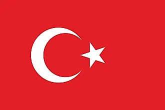
|
| Capital City | Ankara |
| 39 56 N, 32 52 E | |
| Total Area | 783,562.00 km2 |
| Land Area | 769,632.00 km2 |
| Water Area | 13,930.00 km2 |
| Population | 83,429,615 |
| Major Cities |
|
| Currency | Turkish liras (TRY) |
| GDP | $754.41 Billion |
| GDP Per Capita | $9,042.49 |
This page was last updated on February 24, 2021