Maps of Lao People's Democratic Republic

Laos occupies an area of 237,955 sq. km in the Indochinese Peninsula in Southeast Asia.
As observed on the physical map of Laos above, the overall topography of Laos is hilly and mountainous with thick green forests. River valleys and an increasingly steep terrain front the mountainous landscape. The Annamite Mountains and Luang Prabang Mountains are two of the important mountain chains in the country.
The highest point of Laos is Phou Bia whose summit peaks at 9,242 ft. (2,817 m). The lowest point is along the Mekong River at 229 ft. (70 m).
A very small percentage of Laos is farmable, and the limited flat areas (lower lands) are found in the south and along the Mekong River border with Thailand.
As can be seen on the map above, dozens of rivers flow from the upper reaches of the mountains as tributaries of the Mekong, Southeast Asia's most significant river.
The Mekong is the world's 12th-longest river and the 7th-longest in Asia. Its estimated length is 4,350 km (2,703 mi), and it drains an area of 795,000 km2 (307,000 sq mi).
Provinces of Laos Map

Laos (officially, the Lao People’s Democratic Republic) is divided into 17 administrative provinces (Khoueng) and 1 prefecture (Kampheng nakhon). In alphabetical order, the administrative provinces are: attapu, Bokeo, Bolikhamxai, Champasak, Houaphan, Khammouan, Louangnamtha, Louangphabang, Oudomxai, Phongsali, Salavan, Savannakhet, Sainyabuli, Sekong, Vientiane Province, Xiengkhouang and Xaisomboun. Vientiane Prefecture comprises of the capital city of Laos. These provinces are further subdivided into districts and smaller subdivisions.
Located along the banks of the Mekong River, is Vientiane –the capital, the largest and the most populous city of Laos. Vientiane serves as the administrative and economic center of Laos.
Where is Lao People's Democratic Republic?

Laos is a landlocked country situated in Southeast Asia on the north-western part of the Indochinese Peninsula. It is located in the Northern and Eastern hemispheres of the Earth. Laos is bordered by five countries. It is bounded by Myanmar and China to the northwest; by Cambodia to the south; by Vietnam to the east and by Thailand to the west.
Lao People's Democratic Republic Bordering Countries: Vietnam, China, Myanmar, Thailand, Cambodia.
Regional Maps: Map of Asia
Outline Map of Lao People's Democratic Republic

The above outline map represents the landlocked Southeast Asian country of Laos. The map can be dowloaded, printed, and used for coloring or educational purposes.

The above outline map represents the landlocked Southeast Asian country of Laos. The country has an rougly shaped round part in the north that stretches towards the southeast in a peninsula-like region.
Key Facts
| Legal Name | Lao People's Democratic Republic |
|---|---|
| Flag |
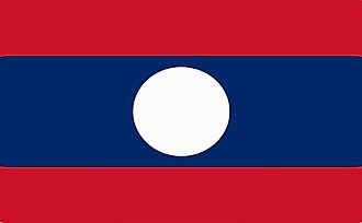
|
| Capital City | Vientiane (Viangchan) |
| 17 58 N, 102 36 E | |
| Total Area | 236,800.00 km2 |
| Land Area | 230,800.00 km2 |
| Water Area | 6,000.00 km2 |
| Population | 7,169,455 |
| Largest City |
Vientiane (721,199) |
| Currency | Kips (LAK) |
| GDP | $18.17 Billion |
| GDP Per Capita | $2,534.90 |
This page was last updated on February 24, 2021