Maps of South Korea

South Korea covers an area of 100,363 sq. km in the southern part of the Korean Peninsula.
As observed on the physical map above, the country is very hilly and mountainous in the east, where the Taebaek Mountains dominate the landscape. The Sobaek Mountains are found in the southern part of the country.The rugged land slopes west into undulating, flatter coastal plains, where most of its people live, and useable agricultural land is found.
These coastal lowlands formed as a result of mountain erosion, and account for only 30 percent of the country.
The western and southern coastlines of the country are covered by thousands of islands and narrow channels; significant rivers include the Kum, Han and Naktong.
The country's highest point is Mt. Halla-san, an extinct volcano located on Cheju Island, at 6,398 ft. (1,950 m). A yellow upright triangle marks the position of this point on the map.
Due to an active reforestation program, over 65% of South Korea's land is covered in forests; up from 35% in 1955, after much of the country's forests were cut down during and after World War II.
Provinces Map of South Korea

South Korea (officially, Republic of Korea) is divided into 9 administrative provinces, 6 metropolitan cities, 1 special city and 1 special self-governing city. In alphabetical order, the provinces are: Chungbuk (North Chungcheong), Chungnam (South Chungcheong), Gangwon, Gyeongbuk (North Gyeongsang), Gyeonggi, Gyeongnam (South Gyeongsang), Jeju, Jeonbuk (North Jeolla), Jeonnam (South Jeolla). The metropolitan cities are: Busan (Pusan), Daegu (Taegu), Daejeon (Taejon), Gwangju (Kwangju), Incheon (Inch᾿on) and Ulsan. Seoul is a special city; while, Sejong is a special self-governing city. These administrative divisions are further subdivided into a number of smaller subdivisions.
Located in the western part of the heart of the Korean Peninsula, Seoul (officially, the Seoul special city) – the capital and the largest metropolitan city of South Korea. It is also the cultural, political and economic center of South Korea.
Where is South Korea?

South Korea is a country in Eastern Asia. It is located both in the Northern and Eastern hemispheres of the Earth. South Korea occupies the southern half of the Korean Peninsula, bordering the Sea of Japan in the east and the Yellow Sea in the west. The southern edge of South Korea rests on the Korea Strait and the East China Sea. The Military Demarcation Line forms the land border between South Korea and North Korea.
South Korea Bordering Countries: North Korea.
Regional Maps: Map of Asia
Outline Map of South Korea

The blank outline map represents South Korea, a country sharing border with North Korea in the Korean Peninsula of East Asia. The map can be downloaded, printed, and used for coloring or map-pointing activities.

The outline map above is of the East Asian country of South Korea that occupies the southern half of the Korean Peninsula.
Key Facts
| Legal Name | Republic of Korea |
|---|---|
| Flag |
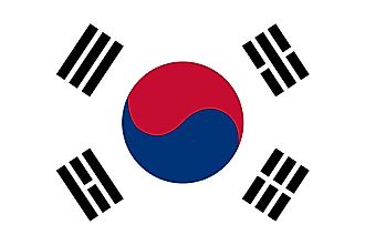
|
| Capital City | Seoul; note - Sejong, located some 120 km (75 mi) south of Seoul, is being developed as a new capital |
| 37 33 N, 126 59 E | |
| Total Area | 99,720.00 km2 |
| Land Area | 96,920.00 km2 |
| Water Area | 2,800.00 km2 |
| Population | 51,709,098 |
| Major Cities |
|
| Currency | South Korean won (KRW) |
| GDP | $1.64 Trillion |
| GDP Per Capita | $31,761.98 |
This page was last updated on February 24, 2021