Maps of North Korea

North Korea covers an area of 120,540 sq. km in the northern half of the Korean Peninsula.
As observed on the physical map of North Korea above, the country is very mountainous. Several mountain ranges and uplands area crisscross the country separated by deep narrow valleys.
As marked on the map by a yellow upright triangle, the highest peak, Paektu-san on the volcanic Baekdu Mountain, is located on its northern border with China, and rises 9,002 ft. (2,744 m). Important mountains found in the country include the Hamgyong, Rangrim, and Kangnam Ranges.
Along the west coast there are wide coastal plains, while along the Sea of Japan (East Sea) coastline (North Korea's lowest point at 0 m), narrow plains rise into mountains. Similar to South Korea, dozens of small islands dot the western coastline.
North Korea's longest river is the Yulu (Yalu). Other large rivers include the Tumen, Taedang, and Imjin.
The lowest point in North Korea is the Sea of Japan at sea level.
Provinces Map of North Korea

North Korea (officially, Democratic People’s Republic of Korea) is divided into 9 administrative provinces and 3 cities. In alphabetical order, these provinces are: Chagang, Hambuk (North Hamgyong), Hamnam (South Hamgyong), Hwangbuk (North Hwanghae), Hwangnam (South Hwanghae), Kangwon, P’yongbuk (North Pyongan), P’yongnam (South Pyongan) and Ryanggang. The cities are: Namp’o, P’yongyang and Rason. These administrative divisions are further subdivided into a number of smaller subdivisions.
Located in the west-central part of North Korea along the banks of the Taedong River is P’yongyang – the capital and largest city of North Korea.
Where is North Korea?

North Korea is a country in Eastern Asia. It is located both in the Northern and Eastern hemispheres of the Earth. North Korea occupies the northern half of the Korean Peninsula bordering the Korea Bay and the Sea of Japan, between China and South Korea. North Korea is bordered by China in the north, by Russia in the northeast, by South Korea in the South. The Military Demarcation Line forms the land border between North and South Korea.
North Korea Bordering Countries: Russia, South Korea, China.
Regional Maps: Map of Asia
Outline Map of North Korea

The blank outline map above represents North Korea, an East Asian country that occupies the northern part of the Korean Peninsula. The map can be downloaded, printed, and used for education purpose like map-pointing or coloring activities.

The outline map above is of North Korea, a sovereign nation occupying the northern half of the Korean Peninsula.
Key Facts
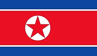
| Legal Name | Democratic People's Republic of Korea |
|---|---|
| Flag |
|
| Capital City | Pyongyang |
| 39 01 N, 125 45 E | |
| Total Area | 120,538.00 km2 |
| Land Area | 120,408.00 km2 |
| Water Area | 130.00 km2 |
| Population | 25,666,161 |
| Major Cities |
|
| Currency | North Korean won (KPW) per US dollar (average market rate) |
This page was last updated on February 24, 2021